SW Climate Outlook - Monsoon Case Study - Pima ALERT Network
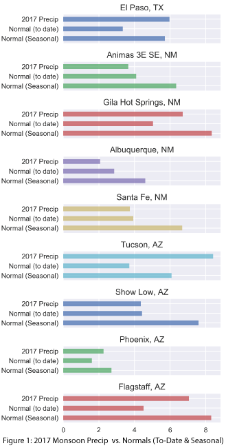
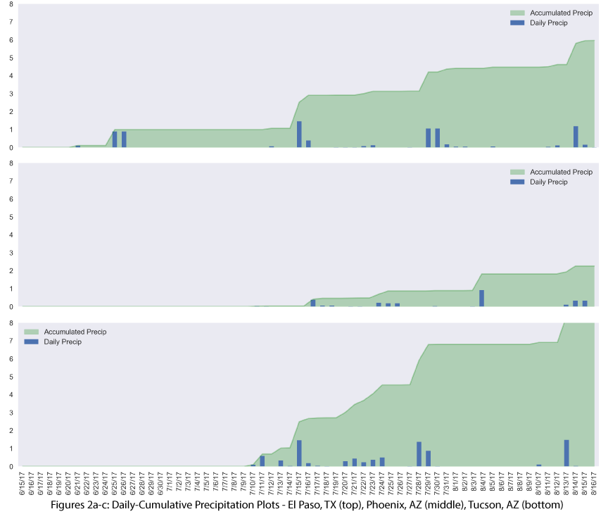
Comparison of the current totals at regional weather stations to normal precipitation-to-date and average seasonal totals gives a better sense of how locations across the region are faring in the monsoon (Fig. 1). Most of the stations in Fig. 1 recorded average to above-average precipitation to date, and a few (El Paso and Tucson) exceeded the monsoon seasonal average (June 15 – Sept 30). Daily cumulative precipitation plots (Figs. 2a-c) show how stations reached their current totals, documenting the intensity of individual days, as well as their contribution to the seasonal total.
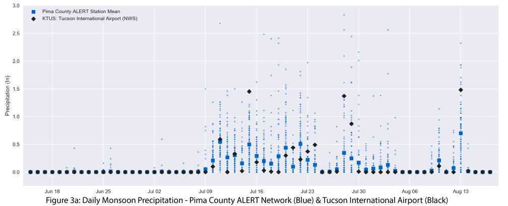
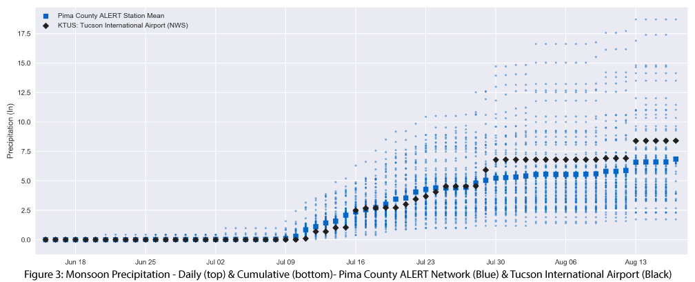
Individual station values provide insight into the regional variability of the monsoon, but what about the local variability? Looking at the Pima County ALERT network sensors (Fig. 3) reveals just how variable the monsoon can be within a region, as well as the fact that daily & cumulative single-station values may not reflect the range of precipitation values observed in the monsoon.
Online Resources / Image Sources
- Figures 1-3: CLIMAS - Climate Assessment for the Southwest
Data Sources