El Niño Tracker - June 2015
Originally Published in the June 2015 CLIMAS SW Climate Outlook (SWCO)
El Niño conditions continued for a fourth straight month with no signs of weakening or disorganizing. Forecasts focused on the persistence of sea-surface temperature (SST) anomalies (Figs.1 - 2) along with weakening trade winds, ongoing convective activity, and El Niño-related ocean-atmosphere coupling. Despite the high degree of uncertainty associated with forecasting El Niño this time of year (the so-called spring predictability barrier), the most recent outlooks from various sources offer a consistent cluster of forecasts calling for a clear El Niño signal that is maintained or even strengthening.
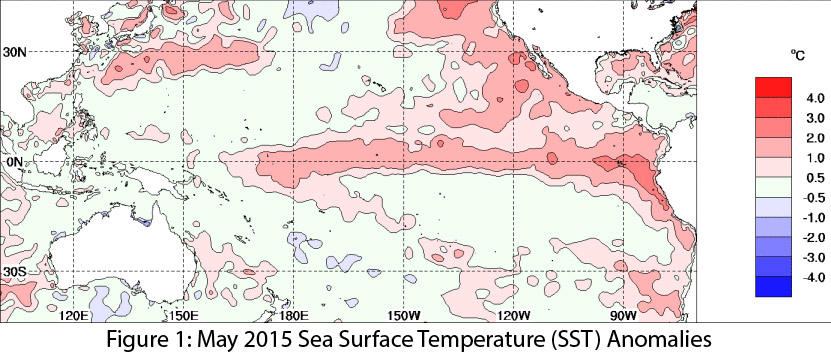
Image Source - Australian Bureau of Meteorology
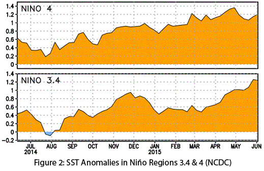
Image Source - National Climatic Data Center
On June 9, the Australian Bureau of Meteorology maintained its tracker at official “El Niño” status, identifying persistent SST anomalies, weak trade winds, and ocean-atmospheric coupling as indicators this El Niño event was strong enough to extend through 2015. On June 10, the Japan Meteorological Agency identified strengthening El Niño conditions in the equatorial Pacific, and forecast that the current El Niño conditions were likely to last until winter. On June 11, the NOAA-Climate Prediction Center (CPC) extended its El Niño advisory with a 90 percent chance that El Niño will continue through fall 2015 and an 85 percent chance the event would last through winter 2015-2016. It pointed to the increasingly positive SST anomalies, along with ongoing ocean-atmospheric coupling and dateline convection activity, as indicators of an ongoing and strengthening El Niño event (Fig. 3). On June 18, the International Research Institute for Climate and Society (IRI) and CPC forecasts indicated continued strengthening of El Niño through 2015, with a moderate event during summer and likely stronger in the fall, lasting into early 2016. The North American multi-model ensemble currently shows a moderate event extending through early summer, with potential for a strong event by mid-summer or early fall (Fig. 4).
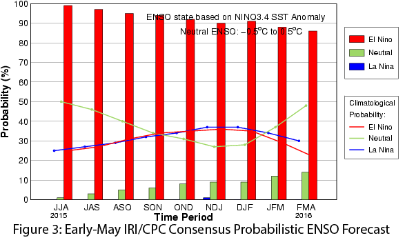
Image Source - International Research Institute for Climate and Society
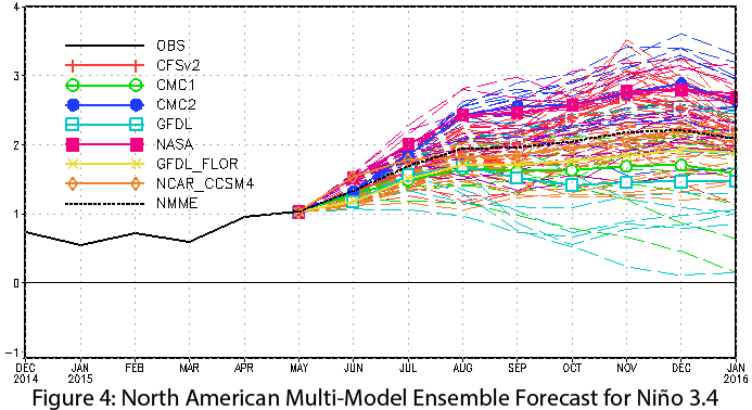
Image Source - NOAA - Climate Prediction Center
Last year’s vacillating signals and forecasts may have led forecasters to take a more conservative approach when presented with similar conditions earlier this year to avoid repeating the “enthusiastic” forecasts of Spring 2014 that didn’t immediately pan out. That said, we appear to be in the midst of an ongoing and strengthening El Niño event. If this event remains on the current trajectory, it could rival our strongest El Niño events of recent memory (1997 in particular), with implications for both Southwest and global communities.
The recent above-average precipitation and below-average temperatures in Arizona and New Mexico are exactly the sort of patterns we expect to see under El Niño conditions. In the immediate future, we may see a return of some early season tropical storm activity, as we did with Hurricane Blanca in June. El Niño also points toward a possible delay in the start of the monsoon, which could actually extend the hotter and drier early portion of summer. We could also see a repeat of 2014’s above-average eastern Pacific tropical storm season, when conditions favorable to El Niño were thought to be driving increased late-season tropical storm activity in the Southwest. And if El Niño persists into winter 2015-2016, particularly if it remains a moderate-to-strong event, we would likely see patterns of above-average precipitation in the Southwest (Fig. 5).
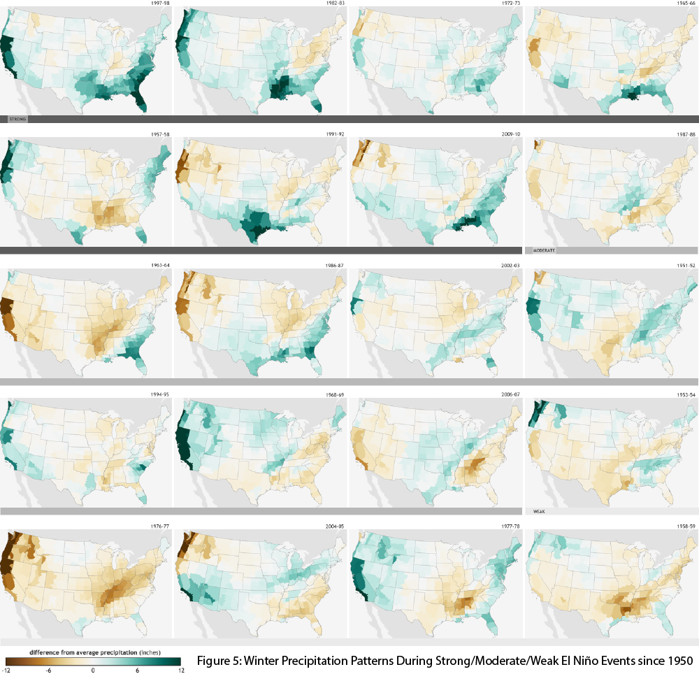
Image Source - NOAA Climate.gov