Winter/Spring Recap 2014-2015
Originally published in the May 2015 CLIMAS SW Climate Outlook
It may not be news to anyone who follows weather forecasting and climate outlooks, but winter 2014–2015 did not play out as expected. Last year, long-term seasonal forecasts keyed in on conditions favorable to the development of an El Niño event and suggested we were more likely to see above-average precipitation in our winter months. This was welcome news to a region that has been affected by a long-term and persistent drought, but rather than sustained above-average precipitation, we saw highly variable precipitation between October 2014 and April 2015 (Fig. 1) and cumulative water year-to-date precipitation that is below average across much of Arizona and parts of New Mexico (Fig. 2 on page 2). Temperature was much less variable, with record or near-record warm average temperatures across most of the western U.S. (Fig. 4 on page 2). So what does this mean for some key areas of concern in the Southwest?
Snowpack and water supply: The combination of below-average winter precipitation and above-average winter temperatures across the western U.S. meant there was less snow in the mountains and that it melted sooner in the season, which has implications for 2015 water supply. There was below-average precipitation overall, and precipitation that did occur often fell as rain instead of snow, with some losses to infiltration (owing to drier soils and the long-term drought) and sublimation (snow essentially evaporating associated with above-average temperatures and low relative humidity). Above-average temperatures also drove earlier-than-normal snowmelt, with most of the western U.S. recording well below-average snow, and many areas were snow-free far in advance of normal.
Wildfire: The repeated incursions of precipitation associated with an above-average eastern Pacific tropical storm season and rainfall tied to typical monsoon patterns drove the growth of fine fuels in the Southwest. This presents an increased fire risk when these fuels dry out, especially when the monsoon is ramping up and we see instances of dry lightning during building storms. The counterpoint is our recent pattern of mild temperatures, increased humidity, and the occasional rainstorm, all of which have tamped down the wildfire risk in the Southwest. This can change quickly if we get the sustained period of windy weather with low relative humidity and high ambient temperatures that is typical of late May and early June.
Pollen, Air Quality, and Human Health: The combination of precipitation last fall and elevated winter temperatures resulted in a banner year for wildflowers in the Southwest but also high pollen counts. Seasonal allergy sufferers will almost certainly already be aware of this, but cumulative exposure to an increasing level and diversity of pollen likely affects those with only infrequent or occasional allergy symptoms as well.
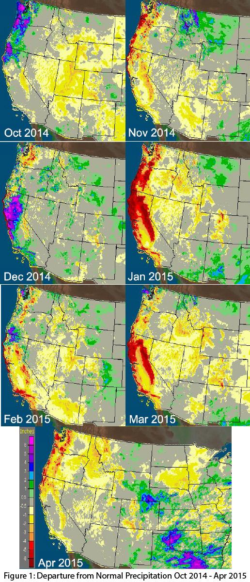 Image Source - NOAA/NWS - Advanced Hydrologic Prediction Service