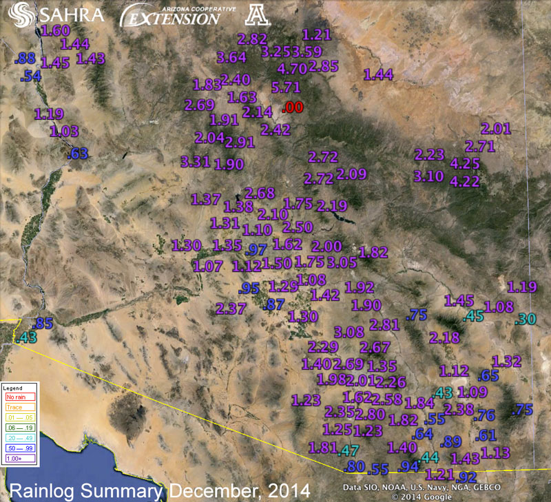
Notes from an Applied Climatologist: Dec 2014 Rainlog Climate Summary
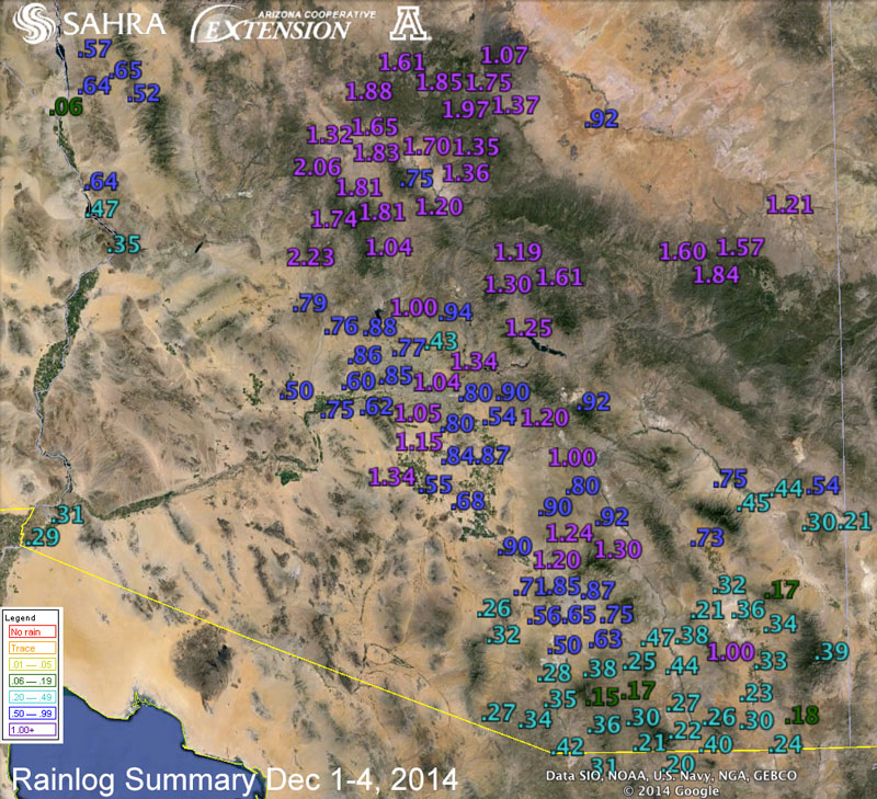
After a very dry and warm November, the weather pattern turned more wintry and active in December bringing some much needed precipitation to Arizona. The first major weather event of the month occurred in the first couple of days as a weak low pressure system interacting with plentiful subtropical moisture brought widespread precipitation to much of Arizona on the 2nd through the 4th of December. This was a relatively warm storm with very high snow levels. Rainloggers from Prescott to Flagstaff reported total rainfall (very few reports of snow) of 1 to 2 inches with this storm system. Much lighter precipitation amounts were recorded by Rainloggers in far southeastern Arizona with amounts of less 0.2 inches.
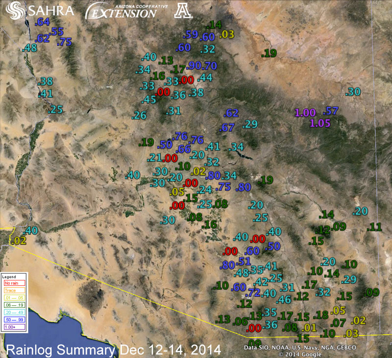
A much colder storm system pushed through the state towards the middle of the month with lower snow levels and more accumulating snow to higher elevation areas. Precipitation amounts were much lighter with this system, though, with Rainloggers from Tucson to Phoenix to Prescott reporting total precipitation amounts of 0.25 to 0.5 inches over the period of December 12th to the 14th. Some higher amounts close to an inch were reported near Sedona and Show Low with much lower amounts (less than 0.2” inches) observed across far southeast Arizona.
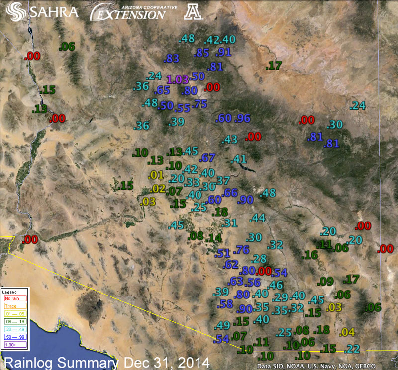
The active weather pattern continued for the rest of the month with quick moving storm systems hitting the state on the 17th and again on Christmas day with light precipitation and snow to higher elevation areas. The month and year ended with a very cold and wet storm system moving through Arizona on New Year’s Eve bringing snow to low desert areas and several feet of snow to mountain locations.
Even with the active weather pattern, only parts of central and southern Arizona near Tucson observed average to above-average precipitation for the month. Much of the rest of the state didn’t keep pace and observed below-average precipitation for December. The latest update of the U.S. Drought Monitor shows that all of Arizona continues to observe short-term drought conditions with little change over the past several weeks.
Overall, 2014 was a strange year of extremes with much of Arizona observing a very dry winter last year and very active summer monsoon season. This left much of southern Arizona with near average precipitation due to the heavy summer precipitation canceling out the dry conditions of last winter. Far northern Arizona still observed below-average precipitation for the year due to both dry winter and summer conditions. All of Arizona observed much above average temperatures for the year with many locations observing their warmest year on record. The Tucson National Weather Service reports that 2014 was the warmest year on record for Tucson with observations going back to 1895.