Notes from an Applied Climatologist: Precipitable Water Q&A
What are the different ways that moisture is tracked in the SW?
Measuring accumulated precipitation is a (relatively) straight forward process that mostly involves a ground-based network of rain gauges that measure the depth of rainfall that accumulates, although some gauges, like tipping bucket gauges, also measure intensity.
Tracking the atmospheric moisture that sets the stage for precipitation events is a much more complicated endeavor. Atmospheric moisture varies at all levels in the troposphere - the lowest level of the Earth’s atmosphere and where our weather happens. This requires a three dimensional approach (really four dimensional when you factor in these measurements are made over time) when measuring and tracking atmospheric moisture.
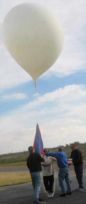
The primary way that the vertical dimension of the atmosphere is sampled is with weather balloons and radiosondes. These are instrument packages attached to helium balloons that measure atmospheric pressure, temperature and humidity, as they quickly ascend (about 1000 ft/minute) through the tropopause. This is done twice a day at approximately 1000 locations across the globe. The data collected through each radiosonde launch creates an atmospheric profile of the wind, temperature and humidity patterns above that location. This atmospheric profile is fed into global weather models and is a critical data component of accurate forecasting.
With respect to atmospheric moisture, the vertical profile gives an indication of where and how much moisture is available for supporting the development of precipitation. High amounts of low level moisture near the surface can be an important source of fuel in the development of unstable air and convective thunderstorms. High amounts of mid-level moisture can sometimes support high-based thunderstorms where the rain that falls evaporates while falling into drier lower levels, producing strong outflows and gusty winds at the surface. When moisture is present at all levels in the atmosphere, these conditions can support widespread, heavy rainfall events.
Precipitable Water

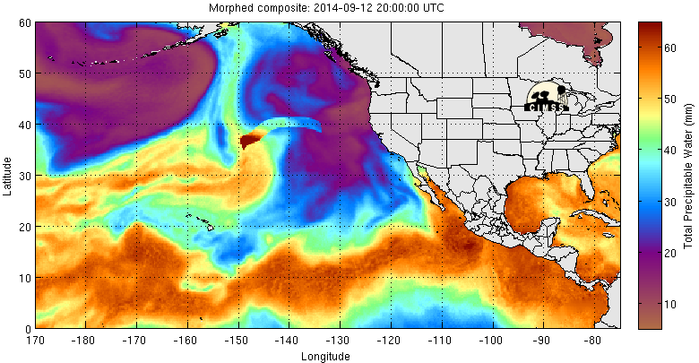
One way of quantifying the total amount of moisture in a vertical atmospheric profile is through the calculation of a metric called precipitable water. This is the amount of water (often in a depth of inches or millimeters) that could be condensed out of a vertical column of air extending up through the troposphere. This value is calculated with the data from each radiosonde sounding twice a day and is also estimated through satellite data as well (see image above).
Precipitable water values are carefully monitored across the southwest U.S. throughout the monsoon season, because they help diagnose the amount moisture available to fuel convective thunderstorms and heavy rain events. Values through the monsoon season can vary widely across the Southwest, but daily values are typically between 1 and 1.5 inches in Tucson as an example. Higher elevation areas have less atmosphere to work with, so precipitable water values will naturally be lower.
To put these values in context, the precipitable water value at Tucson collected from the morning radiosonde on September 8th, the day that widespread flooding occurred across Phoenix and Tucson, was an even 2 inches. This was a record high value for September at the Tucson site. This value of 2 inches of precipitable water actually turned into much higher local precipitation amounts. This is because converging air can cause precipitable water values to pile up and feed individual storms, leading to much higher local precipitation amounts than would be achieved if simply squeezing the water out of a single column of air.
Michael Crimmins is an Associate Professor and Climate Science Extension Specialist in the Department of Soil, Water and Environmental Science
Figure 1: NOAA Weather Balloon - Source: NOAA
Figure 2: Precipitable Water in the Last 72 hours (as of 09.15.2014) - Source: Cooperative Institute for Meteorological Satellite Studies
Figure 3: Precipitable Water Jan-Dec, Tucson AZ - Source: NOAA