Nov 2016 CLIMAS Southwest Climate Outlook - Climate Summary
From the November issue of the CLIMAS Southwest Climate Outlook
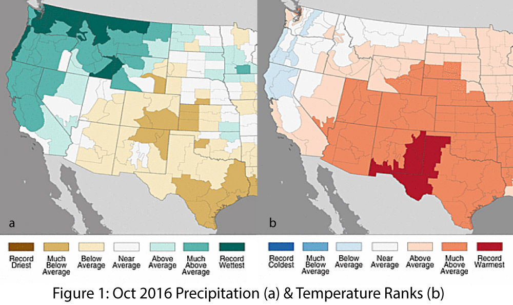
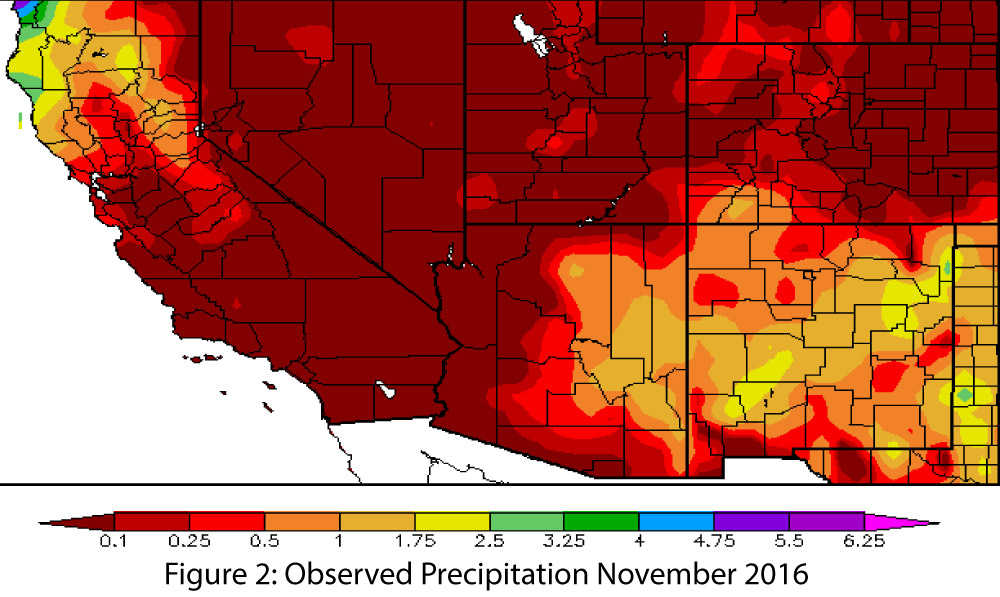
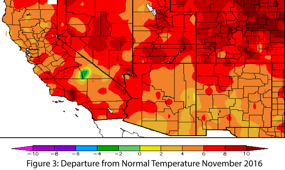
Precipitation & Temperature: October precipitation totals were below average across most of the climate divisions in Arizona and New Mexico, except for parts of western Arizona and central New Mexico (Fig. 1a). October temperatures were much above average across all of the two states, with record-warm observations in southern and eastern New Mexico (Fig. 1b). November precipitation to date has been buoyed by storm events that pushed in as part of a cutoff low. This rainfall may boost the percent of average precipitation calculations to impressive numbers, but the actual amount of rain that has fallen has been relatively meager (Fig. 2). In terms of regional climate, November tends to be one of the drier months. November temperatures have continued the trend observed in October (“Hot-tober”), ranging from 2 to 8 degrees F above normal across most of Arizona and New Mexico, a pattern that extends across the Intermountain West (Fig. 3).
Snowpack & Water Supply: Warm temperatures across the western United States in October and November resulted in early season snowpack and snow water equivalent (SWE) values that are much below average across most of the West. As of November 16, a majority of the stations recorded below 25 percent of average SWE (Fig. 4). A few stations in Arizona and New Mexico have seen recent snow activity, but given persistent high temperatures, it remains to be seen how long this snow will remain. There is ongoing concern that continued western drought conditions may lead to water supply restrictions. For more information, see reservoir storage.

Drought: Long-term drought conditions persist across the Southwest (Fig. 5). According to the U.S. Drought Monitor, most of Arizona is designated as abnormally dry (D0) or experiencing moderate drought (D1). The far southwestern corner of the state is designated as experiencing severe drought (D2), reflecting the persistent multi-year drought conditions extending from central and Southern California. In New Mexico, most of the northern half of the state, along with pockets along the U.S.-Mexico border, are designated as abnormally dry (D0).

ENSO & La Niña: The current outlook for La Niña is not particularly definitive. Borderline weak La Niña conditions persist, and these conditions likely will remain through much of winter 2017. However, models and forecasts continue to identify a rapid decline of La Niña conditions in early 2017, which may limit the influence of La Niña on weather in the Southwest. That said, the climate of the Southwest is inherently dry (i.e., winter is characterized by relatively low precipitation totals in a normal year), and La Niña conditions are more likely than not to increase the chances of a drier-than-average winter. This continues to raise concern given the multi-year drought currently underway in the Southwest and the possibility of water restrictions in coming years if Lake Mead forecasts drop below the 1,075-foot elevation threshold.
Precipitation & Temperature Forecasts: The November 17 NOAA Climate Prediction Center’s outlook for December calls for equal chances of above- or below-average precipitation and increased chances of above-average temperatures. The three-month outlook for December through February calls for increased chances of below-average precipitation (Fig. 6, top) and increased chances of above-average temperatures (Fig. 6, bottom).
