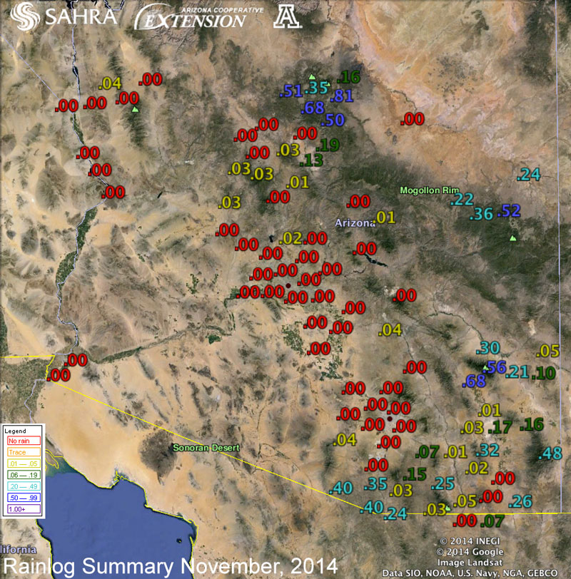
Notes from an Applied Climatologist - Nov 2014 Rainlog Climate Summary
 A pesky ridge of high pressure over the east Pacific dominated the weather for much of November. This steered storms well to our north and east, leaving Arizona with unusually warm and dry conditions.
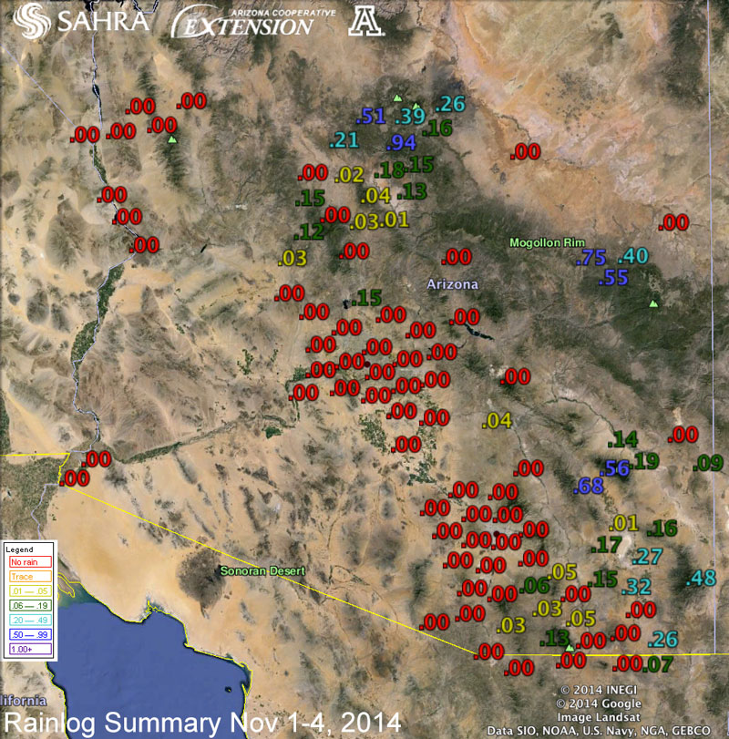
The month started off with promise, as a strong and relatively cold low pressure system dropped down the West Coast, clipping northern Arizona as the storm turned east. This system was largely starved of moisture, but managed to bring some light precipitation (and even some snow) to parts of northern Arizona. Rainloggers in Flagstaff reported precipitation amounts of 0.1 to 0.5” inches on the 1st and 2nd of the month. Other parts of the state, including the area along the Mogollon Rim near Show Low and down into southeast Arizona, saw limited precipitation over the next several days as the low pressure system became a closed low and wandered to the south and into Mexico.
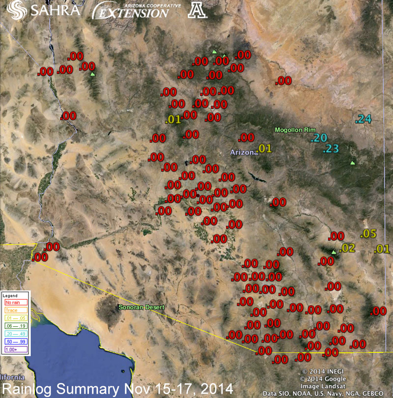 This bit of weather and moisture was short lived. A strong ridge of high pressure quickly built over the east Pacific and desert Southwest causing temperatures to rise well above average and the persistence of a dry weather pattern through the middle of the month. Strong storm systems entering through the Pacific Northwest started to weaken and flatten the ridge towards the middle of the month causing temperatures to moderate to near-average levels across Arizona, but brought very little in the way of precipitation. Northeast Arizona was clipped by a weak system on the 15th and 16th that brought very light precipitation to mostly high elevation areas along the Mogollon Rim. A handful of Rainloggers in the Show Low and Springerville areas reported precipitation amounts of 0.1 to 0.3 inches over this period.
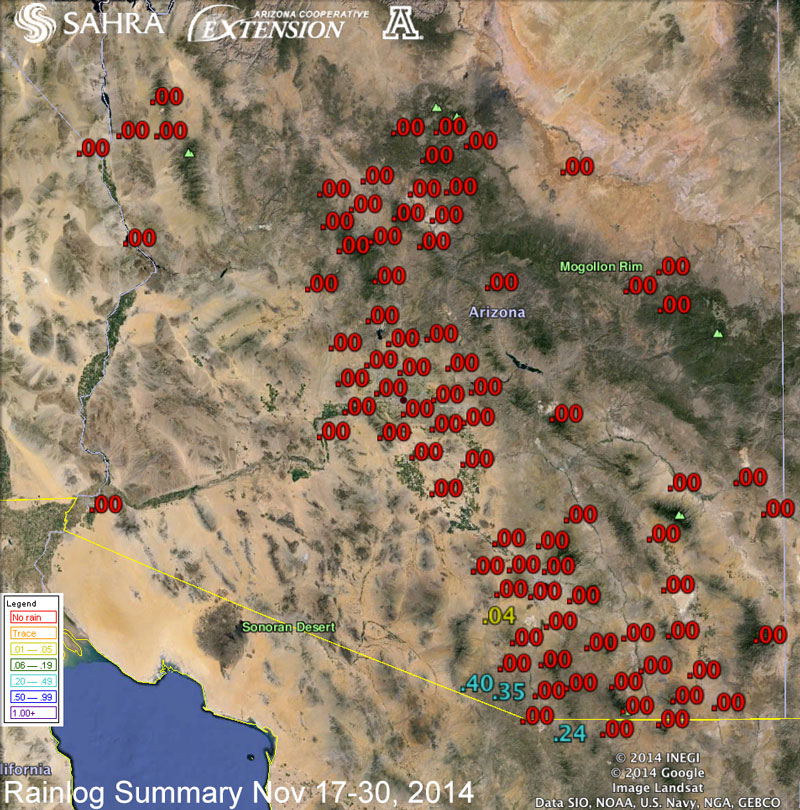 The end of November was again at the mercy of the strong east Pacific ridge as it built quickly again over the last week of the month. Temperatures were at record or near-record levels across the state on the Thanksgiving holiday. The Tucson National Weather Service reported that the high temperature of 83F was the 6th warmest Thanksgiving on record for Tucson.
All of the state observed below-average precipitation with much of the west and central parts of Arizona observing no precipitation at all, and short-term drought conditions remain firmly entrenched across all of the state. El Nino still appears to be on its way and may still bring some relief in the form of average to above-average precipitation over the next several months.