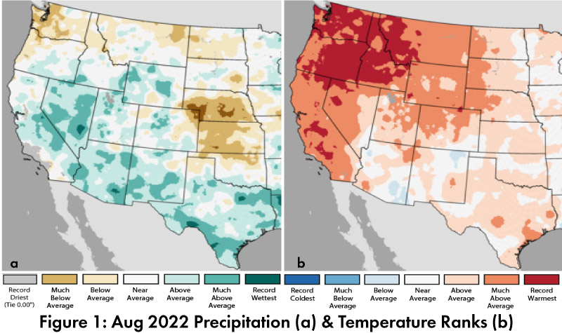
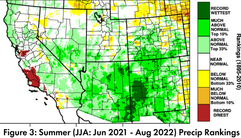
Monthly/Seasonal Precipitation and Temperature: Aug precipitation was above average or much above average in most of Arizona and New Mexico (Fig. 1a). Aug temperatures were between below average and much above average in Arizona and New Mexico (Fig. 1b). Water year precipitation has rebounded considerably with the monsoon, and now ranges between below average and above average in most of Arizona and New Mexico (Fig. 2). Summer (JJA) precipitation rankings for the region demonstrate why, with widespread areas of either record wettest or much above average (Fig. 3).
Drought: The Sept 6 U.S. Drought Monitor (USDM) shows another month of widespread decreases in the severity of drought characterizations in Arizona and New Mexico (Fig. 4) following widespread monsoon activity (See Fig. 3). Despite the regional improvement, drought conditions are still found across most of the southwestern United States. Accumulated precipitation deficits are a factor in these designations. Sustained monsoon activity continues to help reduce extreme drought characterizations but is not enough to fully reverse long-term drought conditions.
Water Supply: Most of the reservoirs in Arizona and New Mexico are at or below the values recorded at this time last year, although many showed modest improvement in August. Most are also below their long-term average (see reservoir storage for Arizona and New Mexico). The shortage declaration for the Colorado River in 2022 and low water levels in the Rio Grande highlight ongoing concerns about the intersection of long-term drought and water resource management, especially with tier 2a restrictions under discussion given current conditions at Lakes Mead and Powell.
ENSO Tracker: The forecast consensus is generally that La Niña is very likely to persist through fall and possibly into winter (see ENSO-tracker for details).
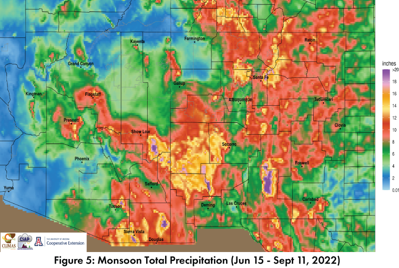
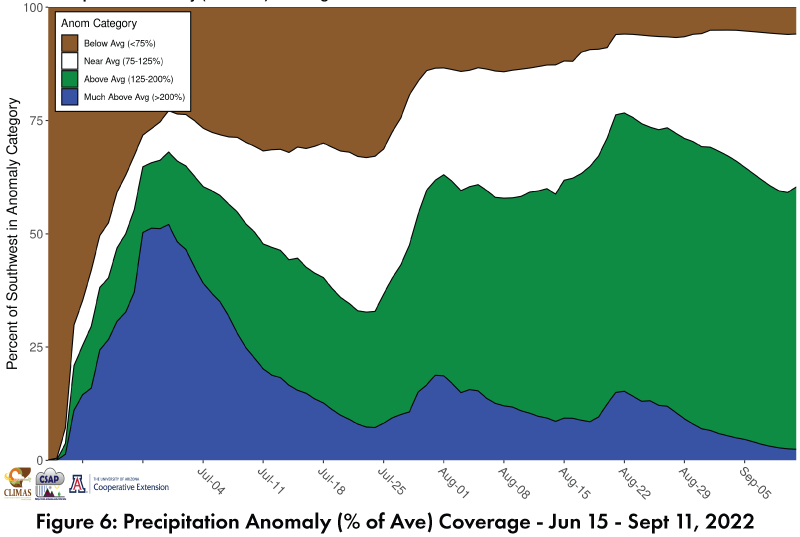
Monsoon: Monsoon precipitation to-date has been widespread across the region (Fig. 5). Early storms in June helped with an early start, and persistent recent activity has brought most of the region to at or above average, calculated as a percent of the average seasonal total to date (Fig. 6, Fig. 3 also shows the spatial pattern). La Niña generally suppresses (but does not eliminate) eastern Pacific tropical storm activity, and TS Kay brought considerable moisture and storm activity to the Southwest in mid-September. If any additional surges in tropical moisture enhance late-season monsoon activity, this will further boost seasonal totals – otherwise, the atmospheric activity that drives ‘typical’ monsoon activity is in rapid decline.