Southwest Climate Outlook November 2020 - Climate Summary
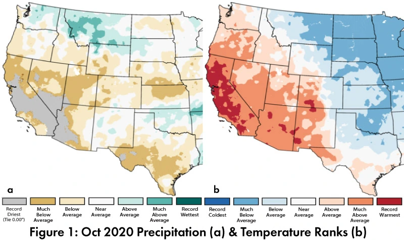
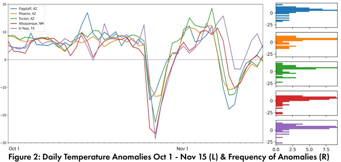
Monthly Precipitation and Temperature: October precipitation ranged from record driest to below average in most of Arizona and from below average to above average in most of New Mexico (Fig. 1a). October temperatures were above average to record warmest in Arizona and near average to record warmest in most of New Mexico (Fig. 1b). The daily average temperature anomalies for Oct. 1 – Nov. 15 (Fig. 2) highlight the fluctuations at select stations around the region (see detailed station data).
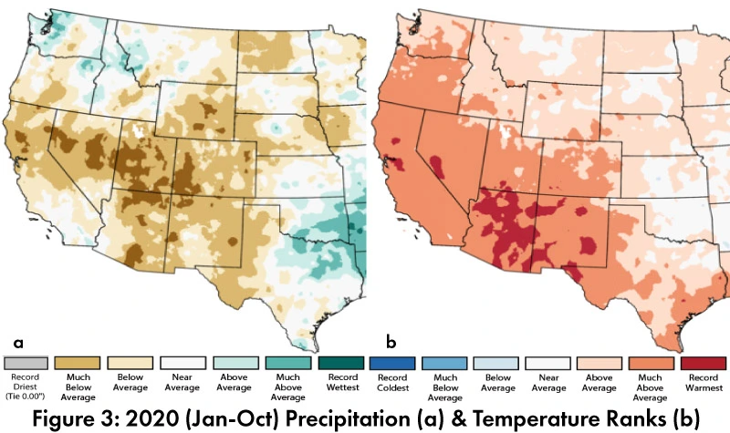
Annual Precipitation and Temperature: 2020 total precipitation percentiles for Jan-Oct ranged between record driest and below average in most of Arizona and New Mexico, with a similar pattern across most of the Southwest (Fig. 3a). 2020 mean temperature percentiles for Jan-Oct were above average to record warmest across the Southwest (Fig. 3b).
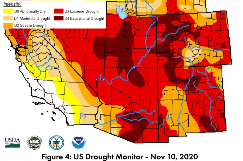
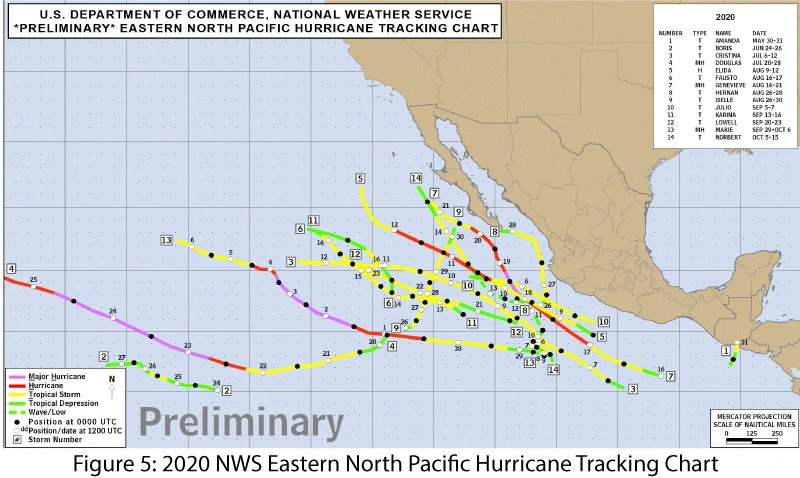
Drought: The Nov 10 U.S. Drought Monitor (USDM) showed widespread areas of extreme drought (D3) and growing pockets of exceptional drought (D4) across Arizona, New Mexico, Nevada, Utah, and Colorado (Fig. 4). A major driver for this drought characterization was well below average monsoon precipitation, lagging fall precipitation, and accumulated long term precipitation deficits. Unlike in some years, the Southwest did not see substantial incursions of moisture from tropical storm activity (Fig. 5).
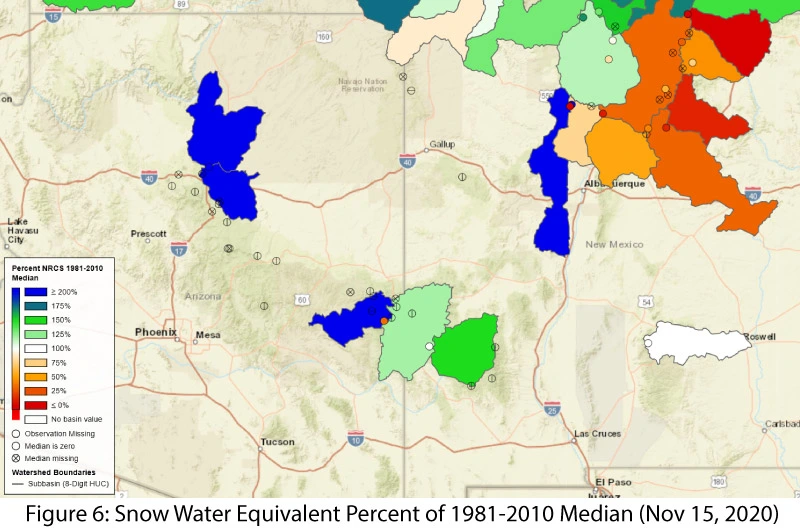
Snowpack and Water Supply: Snow Water Equivalent (SWE) as of Nov 15, 2020 was highly variable across Arizona and New Mexico (Fig. 6). This reflects some areas with early storm activity and other areas lagging behind normal. Note: these basin average and station SWE maps are sensitive to early season storms that can boost totals relative to long term averages, or lag behind owing to slow starts to seasonal precipitation. They will however, provide more meaningful information as the winter season progresses. Many of the reservoirs in the region are at or below the values recorded at this time last year. Most are below their long-term average (see Arizona and New Mexico reservoir storage).
ENSO Tracker: Moderate La Niña conditions are present and expected to last through winter, with a chance of a strong event, resulting in clear signals in seasonal outlooks (see ENSO-tracker).
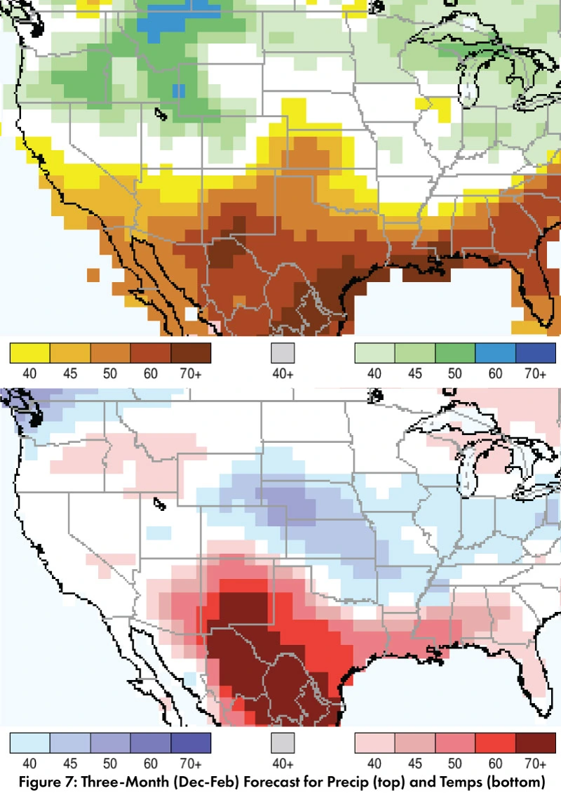
Precipitation and Temperature Forecast: The three-month outlook for Dec through Feb calls for increased chances for below-normal precipitation across the southwestern U.S. and northern Mexico (Fig. 7, top). The three-month temperature outlook calls for increased chances of above-normal temperatures across much of the southwestern U.S. and northern Mexico (Fig. 7, bottom).
Online Resources
- Figures 1, 3 - National Centers for Environmental Information - ncei.noaa.gov
- Figure 2 - Climate Assessment for the Southwest - climas.arizona.edu
- Figure 4 - U.S. Drought Monitor - droughtmonitor.unl.edu
- Figure 5 - National Hurricane Center - nhc.noaa.gov
- Figure 4 - National Resource Conservation Service - nrcs.usda.gov
- Figure 7 - International Research Institute for Climate and Society - iri.columbia.edu

