Feb 2018 Southwest Climate Outlook - La Niña Tracker
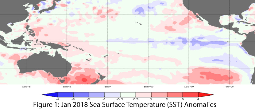
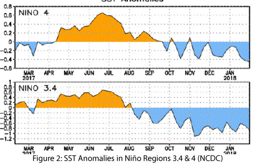
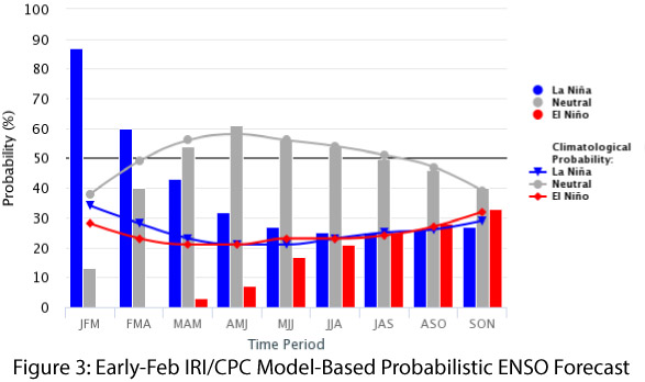
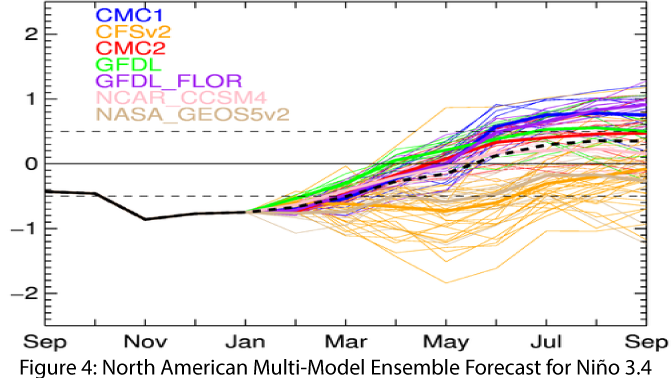
La Niña conditions continued for another month, with both atmospheric and oceanic conditions demonstrating a La Niña pattern (Figs. 1-2). Forecasts continue to suggest a weak-to-moderate La Niña event that has likely peaked and will gradually weaken this spring. On Jan. 30, the Australian Bureau of Meteorology saw evidence in recent observations that the event has peaked and is likely already in decline. On Feb. 8, the NOAA Climate Prediction Center (CPC) continued its La Niña advisory based on oceanic and atmospheric conditions, but identified a 55-percent chance of a transition to ENSO-neutral in the spring. On Feb. 8, the International Research Institute (IRI) issued its ENSO Quick Look calling for La Niña to last into the spring (Fig. 3) as a weak-to-moderate event, with a likely return to neutral conditions by mid-spring. On Feb. 9, the Japanese Meteorological Agency (JMA) identified ongoing La Niña conditions straddling weak to moderate strengths and called for a 70-percent chance that the event will end this spring. The North American Multi-Model Ensemble (NMME) is consistently indicative of a weak La Niña event returning to neutral conditions by spring (Fig. 4).
Summary: This La Niña event has hovered in the weak-to-moderate range, although it appears to have finally reached moderate strength at the time of this writing. La Niña strength matters in the Southwest, but intensity is not the only factor that affects winter temperature and precipitation patterns. Warmer- and drier-than average winter conditions are associated with La Nina events of any strength, so the presence of La Nina is certain to heighten concerns about winter precipitation and drought, regardless of strength. At the same time, Southwest winters are relatively dry to begin with, so the existence of La Nina does not necessarily bring winter conditions that depart radically from normal, even as they are reliably not wetter than average. However even ENSO-neutral winters have included some of driest (as well as wettest) winters on record. One notable linkage when looking at past events is La Niña conditions generally take wetter-than-average winters off the table. The recent winter storms in the Southwest represent a welcome change, but given the conditions observed so far this winter, a warmer- and drier-than-normal winter certainly appears to be the most likely trajectory.
Online Resources
- Figure 1 -Australian Bureau of Meteorology - bom.gov.au/climate/enso
- Figure 2 - NOAA - Climate Prediction Center - cpc.ncep.noaa.gov
- Figure 3 - International Research Institute for Climate and Society - iri.columbia.edu
- Figure 4 - NOAA - Climate Prediction Center - cpc.ncep.noaa.gov