SW Climate Outlook Monsoon Tracker - Sept 2017
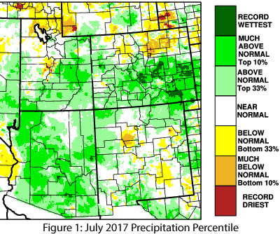
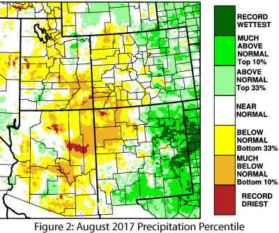
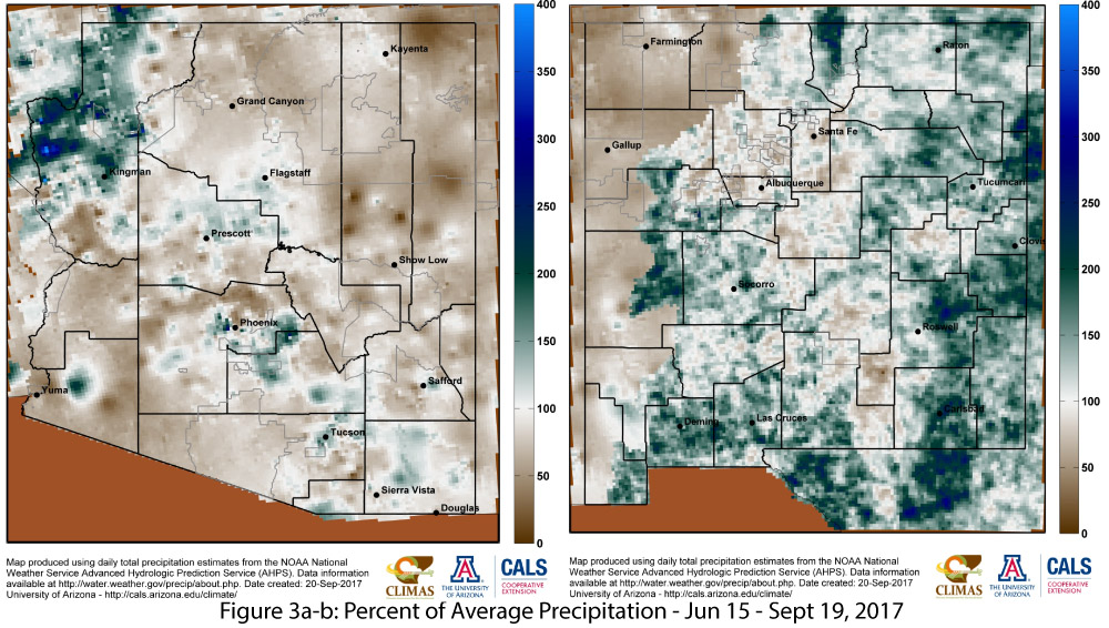
The North American monsoon was quiet for much of the Southwest through early July, but mid-July through early August saw an impressive run of storms. July was particularly active in southeast Arizona, where numerous locations approached or set single-month records for precipitation. Since early August, however, Arizona has experienced a widespread shutdown of monsoon activity, while New Mexico has seen more regular precipitation. Seasonal totals (June 15 – Sept 13) for weather stations in regional metropolitan areas range from below to above average (see Fig. 3 from Climate Summary), with the more impressive totals (Tucson, El Paso) resulting from near-record precipitation in July. The second half of August and September so far have been disappointingly below average, or at best near average for many locations. Looking at precipitation maps for specific months, July was mostly above normal (top 33 percent) and much-above normal (top 10 percent) across nearly all of Arizona and much of western and northern New Mexico (Fig. 1). August flipped that script, with most of Arizona and western New Mexico recording below-normal or much-below-normal precipitation, and with a large pocket of dry conditions centered over the Four Corners region even while eastern New Mexico was much-above normal to record wettest (Fig. 2). Looking at the cumulative seasonal precipitation totals moderates the large monthly variations (see percent of normal through Sept. 19; Fig. 3), and reveals a high degree of spatial heterogeneity of precipitation across the region. In other words, it was a normal monsoon.
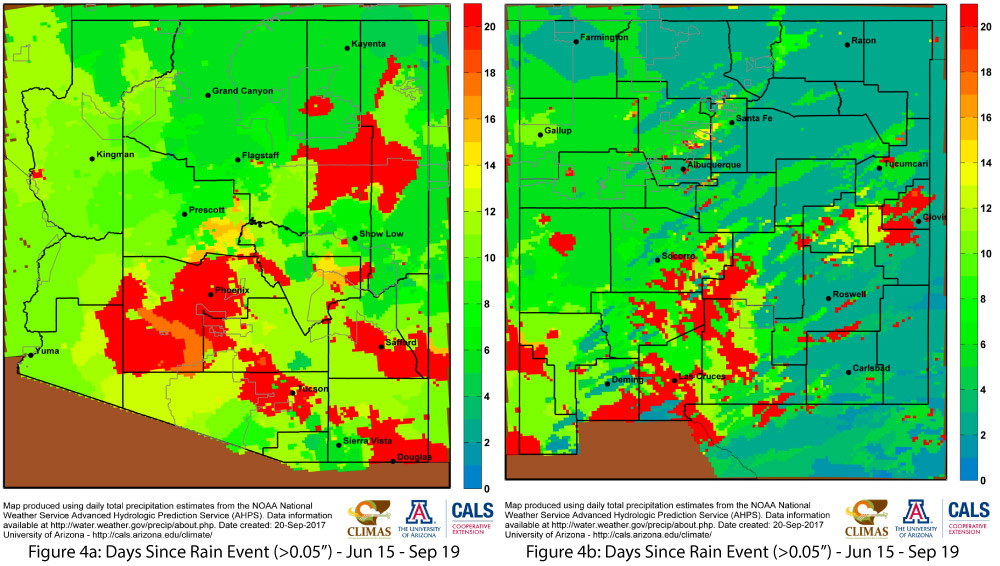
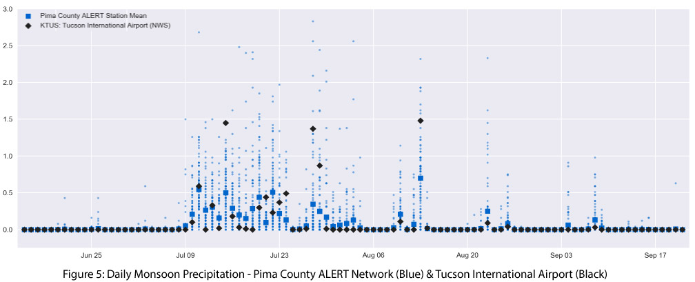
Another way to assess the dry conditions of the last 30 to 45 days is by looking at the number of days since a rain event greater than 0.05 inches (Figs. 4a-b). These maps highlight widespread areas of Arizona and New Mexico that have recorded 20 or more such “dry days” and much larger areas for which it has been 10-15 days since the last rain event. Variable precipitation is a fundamental characteristic of the monsoon, so these gaps are generally expected to occur. Since the bulk of monsoon precipitation falls during July and August, an extended dry run starting in mid-August will limit the overall seasonal total for the region. We are seeing this now, as seasonal totals are mostly falling close to climatology in spite of the higher expectations that were set over the wet period from mid-July to early August (Fig. 5).
There is still a chance of additional precipitation in the remaining days of the official monsoon (which ends on Sept. 30), but activity during this time of year is often attributable to an influx of moisture from eastern Pacific tropical storms that recurve back into the Southwest, especially later in the tropical storm season. Currently, there are no such events forecasted over the next few weeks, thus the current monsoon precipitation totals are likely to also be the final seasonal totals. September 30 only marks the official end of the monsoon, but not an end to potential moisture influx to the Southwest from tropical storms, as evidenced by numerous October events that have resulted from such activity.
Online Resources - Image Credits
- Figures 1-2 - West Wide Drought Tracker
- Figure 3 - Climate Science Applications Program
- Figures 4a-b - Climate Science Applications Program
- Figure 5 - CLIMAS: Climate Assessment for the Southwest
- CLIMAS Monsoon Hub