Southwest Climate Outlook April 2015 - Climate Summary
Precipitation: In the past 30 days, most of the southwestern U.S. received below-average precipitation (Fig. 1). The winter wet season is wrapping up, and instead of above-average precipitation (as many of the El Niño influenced seasonal forecasts suggested), water year observations since October 1 show below-average precipitation across much of Arizona and portions of New Mexico. The situation is direr in other western regions, with California, the Pacific Northwest, and the Intermountain West recording significantly below-average winter precipitation (Fig. 2).
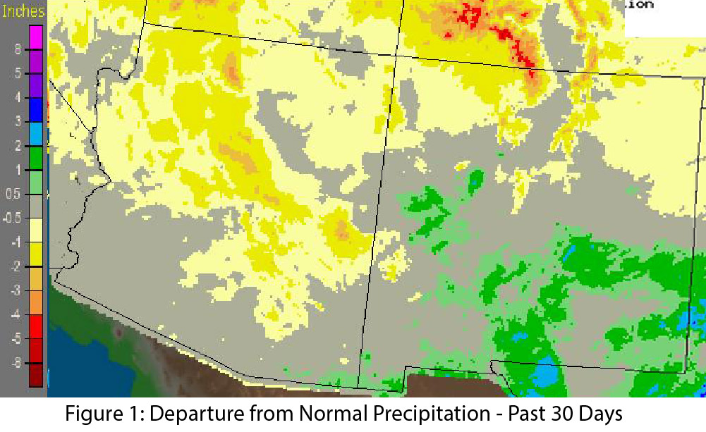
Image Source - NOAA/NWS - Advanced Hydrologic Prediction Service
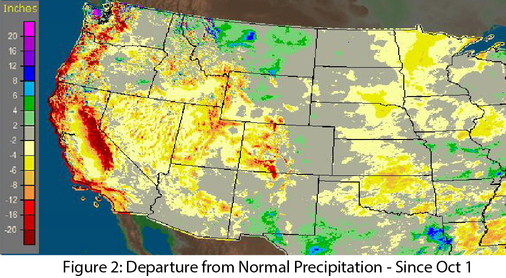
Image Source - NOAA/NWS - Advanced Hydrologic Prediction Service
Temperature: In the past 30 days, temperatures were above-average across Arizona and New Mexico, with anomalies between 4 to 8 degrees F above average across most of the region (Fig 3). In the six months since the water year began on October 1, Arizona, California, Nevada, Oregon, and Washington saw record-warm average temperatures (Fig. 4).
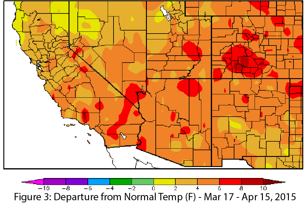
Image Source - High Plains Regional Climate Center
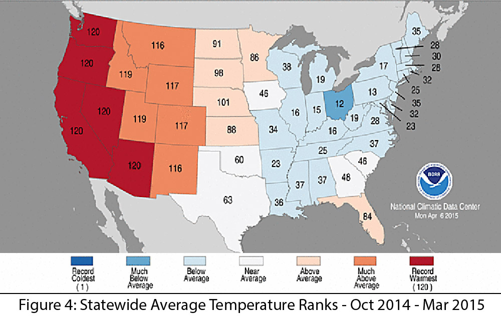
Image Source - National Climate Data Center
Snowpack: High temperatures and below-average precipitation led to limited snowpack across the western U.S. As of April 16, snow water equivalent (SWE) is below average in every basin in the West (Fig. 5). In our region, SWE ranged from 0 to 32 percent of average in Arizona and 0 to 50 percent of average in New Mexico.
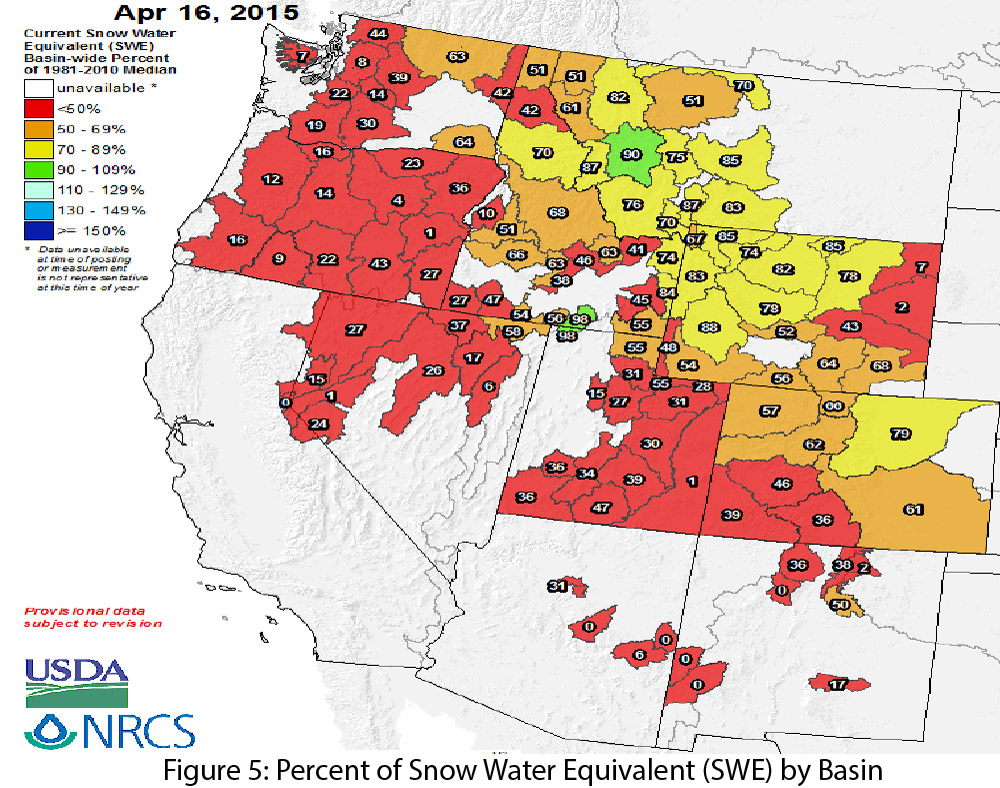
Image Source - Natural Resources Conservation Service - NRCS
Drought & Water Supply: The U.S. Drought Monitor highlights persistent drought conditions across the West and identifies both short- and long-term drought conditions in Arizona and New Mexico. Total reservoir storage in March was 45 percent in Arizona (same value as last year) and 26 percent in New Mexico (compared to 24 percent last year) (see reservoir storage on page 5 for details).
Wildfire: There is potential for wildfire in any month of the year, but March through June is the windiest time of year (see page 4), which increases likelihood of red flag warning days. This is also one of the driest times of the year, so all eyes are on fire risk potential from now through the onset of the monsoon.
El Niño: Despite a relatively late start, El Niño continued for a second consecutive month, with potential for a stronger event as we look forward towards summer and fall of this year (see page 3 for details).
Precipitation & Temperature Forecasts: The April 16 NOAA-Climate Prediction Center seasonal outlook predicts above-average precipitation this spring into summer for most of the Southwest and Intermountain West, although California and southern Arizona are notable exceptions. Temperature forecasts remain split across the region, with elevated chances for above-average temperatures along the West Coast and eastward into Arizona (and most of the western U.S.), and increased chances for below-average temperatures in western Texas and into eastern New Mexico.
Streamflow Forecasts: The April 1 forecast for the Colorado, Rio Grande, and Arkansas river basins project well below-average streamflow for Arizona and New Mexico. This pattern is repeated across much of the western U.S., especially in Utah, Nevada, California, New Mexico, and Arizona (Fig. 6), following the unusually warm and dry conditions in March.
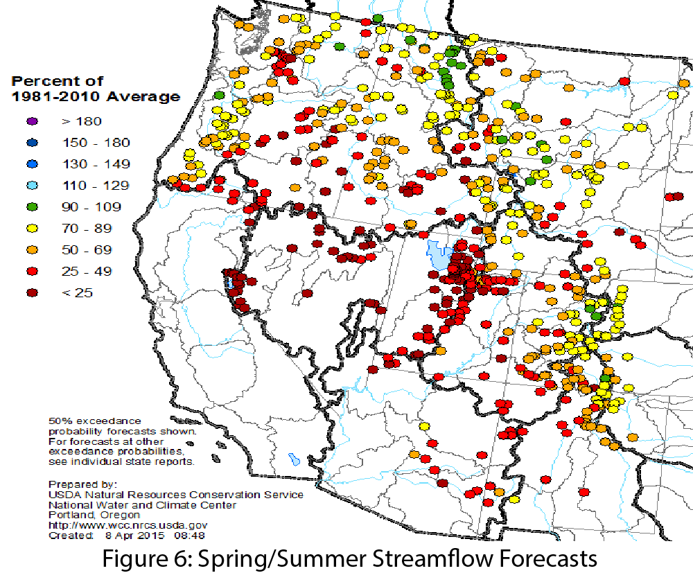
Image Source - Natural Resources Conservation Service - NRCS

