Monsoon Summary (June 15 - July 15)
Originally published in the Southwest Climate Outlook, released the 3rd Thursday of every month. Sign up for email newsletter version.
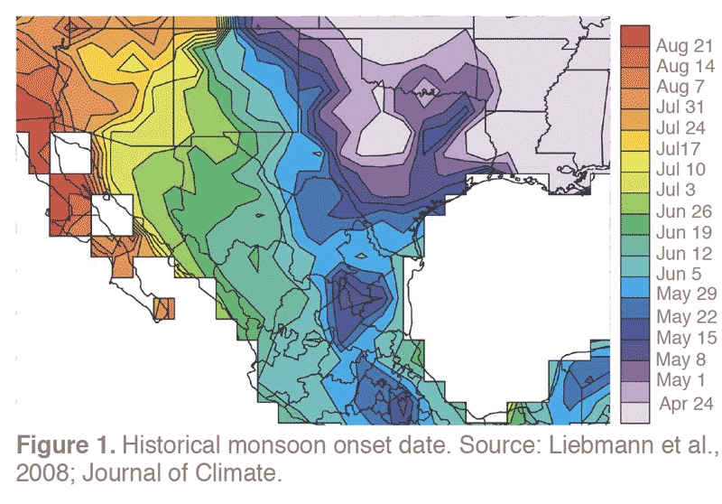
Monsoon storms began around July 3 in many parts of southern Arizona. The average onset date of the monsoon in southeast Arizona is between July 1 and 6 (Figure 1). In months that preceded the monsoon, climatologists speculated that a developing El Niño event could delay the onset, an interpretation based on past analogs. This did not occur, in part because the atmosphere has yet to respond to the El Niño, despite warmer-than-average sea surface temperatures (SSTs) in the tropical Pacific Ocean (see El Niño Watch for details).
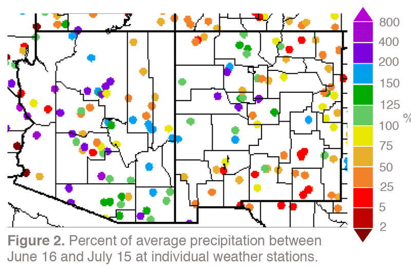
Many parts of Arizona received above-average precipitation last month thanks to monsoon rainfall (Figure 2). The spotty nature of the monsoon, however, belies sweeping characterizations that apply to all regions because above- and below-average rainfall is often experienced over short distances not captured by more sparsely located rain gauges. The Prescott area of Arizona, for example, has not yet been doused as much as other areas. Nonetheless, many weather stations in southeastern Arizona have measured above-average rainfall since June 15. These include the Tucson International Airport and airports in Douglas and Nogales, where rain has measured 1.61, 2.59, and 3.4 inches since June 15, respectively. These totals amount to 0.45, 1.01, and 1.14 inches above average, respectively. Sierra Vista logged 4.87 inches of rain—3.36 inches above average.
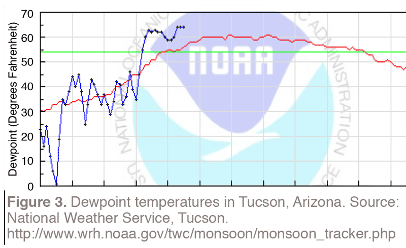
Many places around Arizona have felt above-average humidity. This is reflected in dewpoint temperatures, which increase as moisture content in the air increases, across the state. In Tucson, for example, dewpoints often have been above 60 degrees F (Figure 3), as they have in Phoenix and Yuma. These humidity levels indicate that moisture is present and, if other conditions converge, storms will result. The intensity and geographic coverage of the storms, however, also depend in part on atmospheric temperature gradients that enable air to rise, condense, and squeeze out rain, and on the presence of winds aloft that push storms off the mountains. Even if rain does not fall, higher levels of humidity help suppress fire risk, and fire restrictions across the regions are being eased.
While southern Arizona generally has experienced an active monsoon thus far, the opposite story has evolved in southern New Mexico and southwest Texas (Figure 2). El Paso, for example, has only received 0.32 inches of rain, or about 0.8 inches below average. The position of the high pressure system, which has largely been centered north of southeast Arizona, has helped create this juxtaposition. On the western, Arizona side of the system, moisture-laden air has been streaming from the south, whereas dry air has been wafting from the north on the eastern, New Mexican side.