Monsoon Summary (June 15 - Aug 19)
The 2014 monsoon can be characterized many ways—the amount and intensity of rain has been spotty both spatially and temporally, the humidity has been persistently high, and precipitation has improved short-term drought conditions in many areas. Certainly it cannot be characterized as a dud.
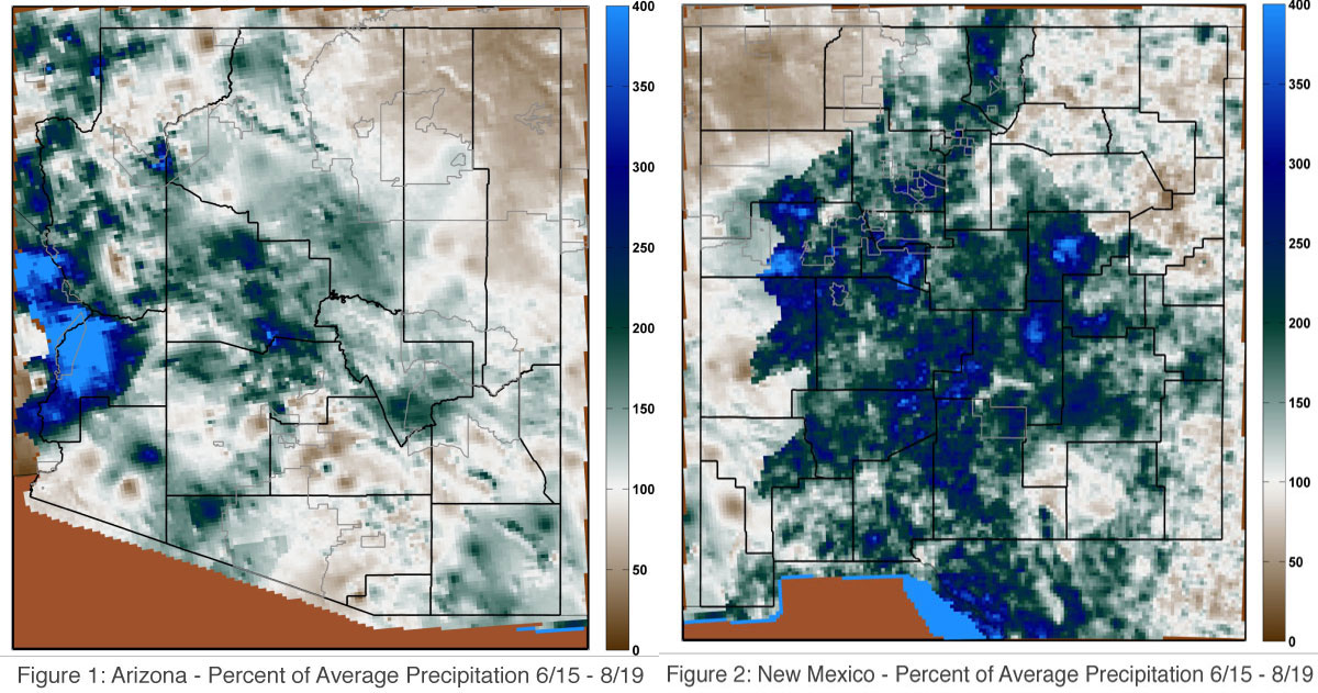
With about a month remaining in the 2014 monsoon season, southeast Arizona, the higher elevation areas in central Arizona, and west-central Arizona have generally experienced above-average precipitation (Figure 1). West-central Arizona historically experiences less monsoon rainfall and more infrequent storms then other regions, and this year only a few storms have generated most of the observed rainfall in this region. Consequently, west-central Arizona boasts higher storm intensity, a metric that takes the total accumulated precipitation and divides it by the number of days with precipitation. Using this metric, west-central Arizona has an intensity of 0.5 inches per day; many of the higher elevation regions also have a similar intensity, where as the desert values are less than 0.2 inches per day. A notable exception occurs around Phoenix where 2–3 inches of rainfall fell on August 19 (with some nearby stations tallying as much as 5–6 inches) and caused severe flash flooding. In New Mexico, precipitation has been above average across most of the state and in particular within the Rio Grande basin (Figure 2). Consequently, short-term drought conditions have improved in recent weeks, although water storage is still low from the accumulated impacts of below-average winter rain and snow over the last decade.
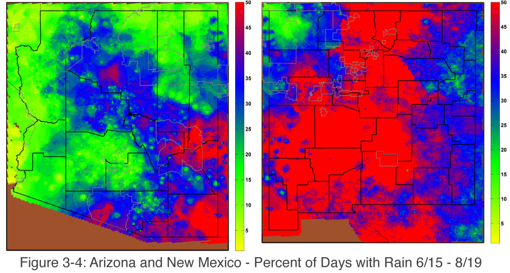
The frequency of rain tells another story and shifts the focus to southeastern Arizona. In this region, precipitation greater than 0.1 inches has fallen during half of the days since June 15 (Figure 3). Most rain gauges in this region have measured near-average or above-average precipitation. Monsoon storms have also been frequent in New Mexico, with most of the state experiencing rainfall on half of the days since June 15 (Figure 4).
Tropical storm activity in the eastern Pacific Ocean has also been active, although all eight of the named cyclones have tracked westward away from the North American continent. Hurricane activity is expected to continue through October; this could bring even more moisture to the Southwest, as some of the biggest floods on record have occurred from decaying tropical storms wafting over the region.
This post was originally published as part of the August 2014 Southwest Climate Outlook