Flood Justice in South Texas

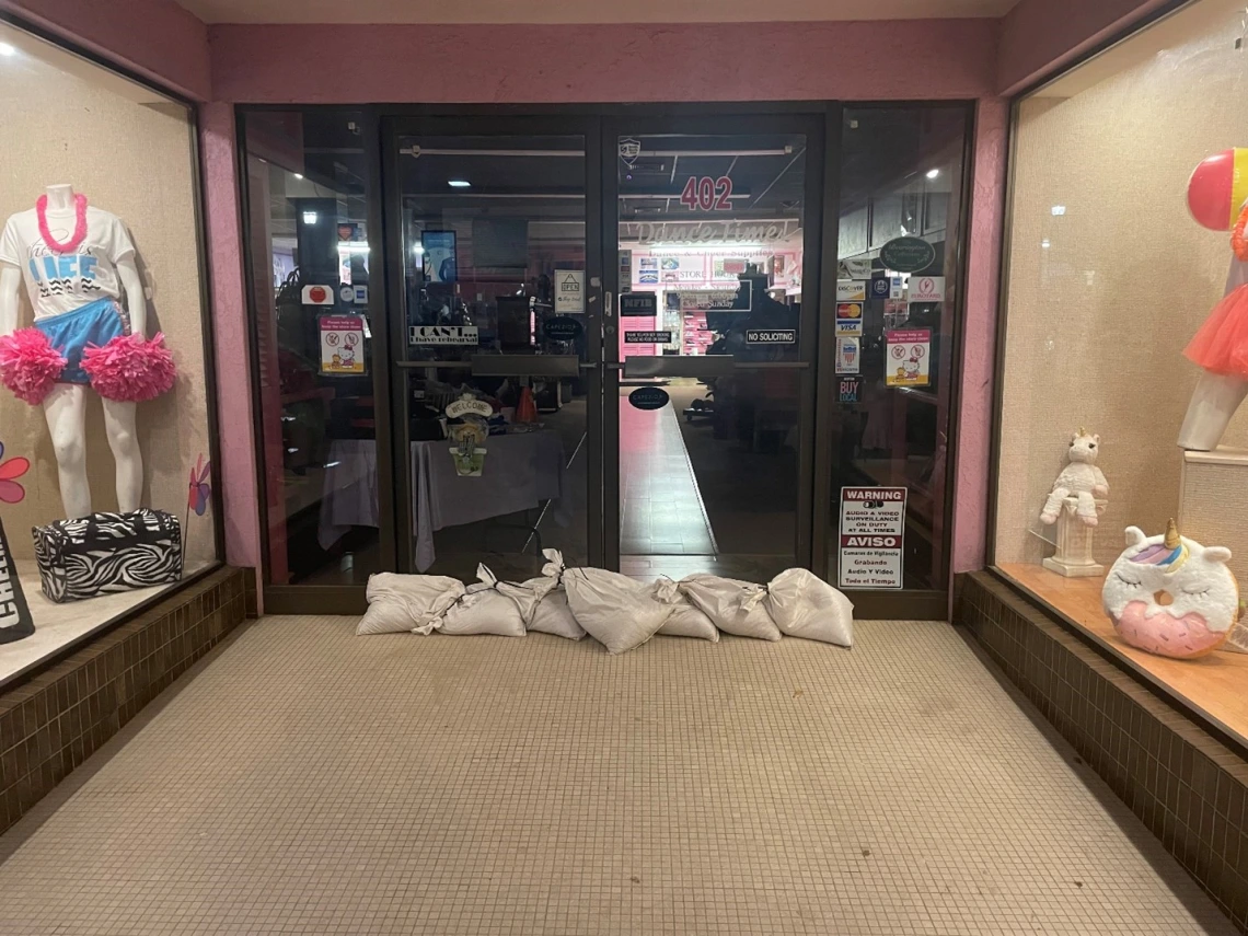
It was an open and blue Texas sky on the 3.5-hour drive south from San Antonio, Texas to the Rio Grande Valley. Yet when I arrived in this four-county region at the southern tip of Texas-Mexico border, I quickly realized the topic of this research trip – destructive seasonal floods – were predicted to happen that very week. In meeting after meeting with community-based environmental justice organizations, I heard similar stories about the ongoing challenges of flood injustice in the colonias – low-income, largely Mexican and Mexican-American, informal communities that are particularly susceptible to flooding. Within 48 hours of arriving, sandbags filled the entrances of storefronts and tornado watches were in effect. I began checking weather reports hourly out of concern that these potential floods would inundate the very communities I was there to serve. I thought to myself, how can I support these post-aid efforts? Would I just be in the way? Selfishly, I wondered if this would derail the carefully planned workshop I had been organizing and had travelled to facilitate.
Perhaps most jarringly, I began to read about free sandbag distribution programs that city governments throughout the Valley offered. All you needed to receive this simple flood mitigation tool was an address to prove residency in these cities. Providing an address sounds innocuous, but the very people most at risk of these seasonal floods are unincorporated colonia communities, the very communities I aimed to support with this research, and the communities who would be denied this simple flood mitigation support because they lived on the outskirts of these cities. While there were ultimately no floods from this storm, a deadly tornado swept through a colonia near Brownsville, Texas – a border town on the eastern edge of this region.

Photo by author: While facilitating the FLUJOS RGV launch heavy rains and floods were predicted. This small business used sandbags to block the potential inundation.
My connection to the Texas-Mexico borderlands is not simply intellectual, it’s also personal. I was raised in a mixed-race family with relatives on both sides of the border. As children we would visit the home of my Abuelitos [grandparents] in the rural mobile home where my mother and her brothers and sisters were raised. As a child in Austin, Texas the racial segregation of the city was (and remains) palpable where Black and Latinx families fight for affordable housing in a rapidly gentrifying, but historically redlined, East Side. This experience inspired my career in advocacy and restorative justice. I worked in the housing and environmental justice space for several years with community-based organizations across the US, many along the US-Mexico border. During this time, I learned the devastating cost of floods on homes, health, and economic prosperity in the Rio Grande Valley.
The vulnerability to flooding in these communities is perpetuated by FEMA’s denial of post-flood aid and the limited support for flood mitigation infrastructure by the local and federal government. Often FEMA denies aid based on ‘deferred maintenance’, meaning the quality of the home was too poor to justify aid. The result has been exclusion of these already low-income and largely Latinx communities. This injustice – which, given the predominantly Mexican and Mexican-American population of these communities is largely racialized – is precisely what these community-based organizations are fighting against. A critical barrier for these community organizations, which includes housing and legal aid non-profits, labor organizers, and public health organizations, is the lack of quantitative data. Put simply, we have no database showing where repeat floods are happening nor the duration or impact of inundation events. Without these data, convincing the local government to provide flood support has been challenging and local organizations worry that federal flood mitigation infrastructure grant applications are less competitive.
To fill this data gap, I co-developed a research project with Dr. Beth Tellman’s Social[Pixel] Lab called FLUJOS - RGV (Flood Justice Utilizing Satellite Observations – Rio Grande Valley). This collaborative research project includes several community-based organizations, with the Texas RioGrande Legal Aid (TRLA) as our chief collaborator and utilizes satellite imagery to detect the extent and duration of past flood events. FLUJOS - RGV launched with an in-person kickoff in May 2023 and brought various organizations together to discuss how satellite imagery might support their advocacy efforts. The research project is driven by the question: how can satellite imagery for flood detection empower communities to challenge flood injustice? To ensure that the data produced by this project is impactful, FLUJOS – RGV utilizes the human centered design concept of co-production. Human centered design serves as a model that not only sees researchers and collaborators as equal contributors but centers local perspectives in developing the project database and in understanding how this database can be utilized to challenge flood injustice. As contributors we are asking our partners to share not only their knowledge of floods, but to walk us through their specific and detailed data challenges. In doing so, FLUJOS centers the local knowledge of partner organizations and the lived experience of colonia residents. Now that we’ve launched FLUJOS RGV I am excited about our upcoming workshops (September 2023) to co-develop a comprehensive list of major flood events in the region and better understand the Theories of Change for our partner organizations.

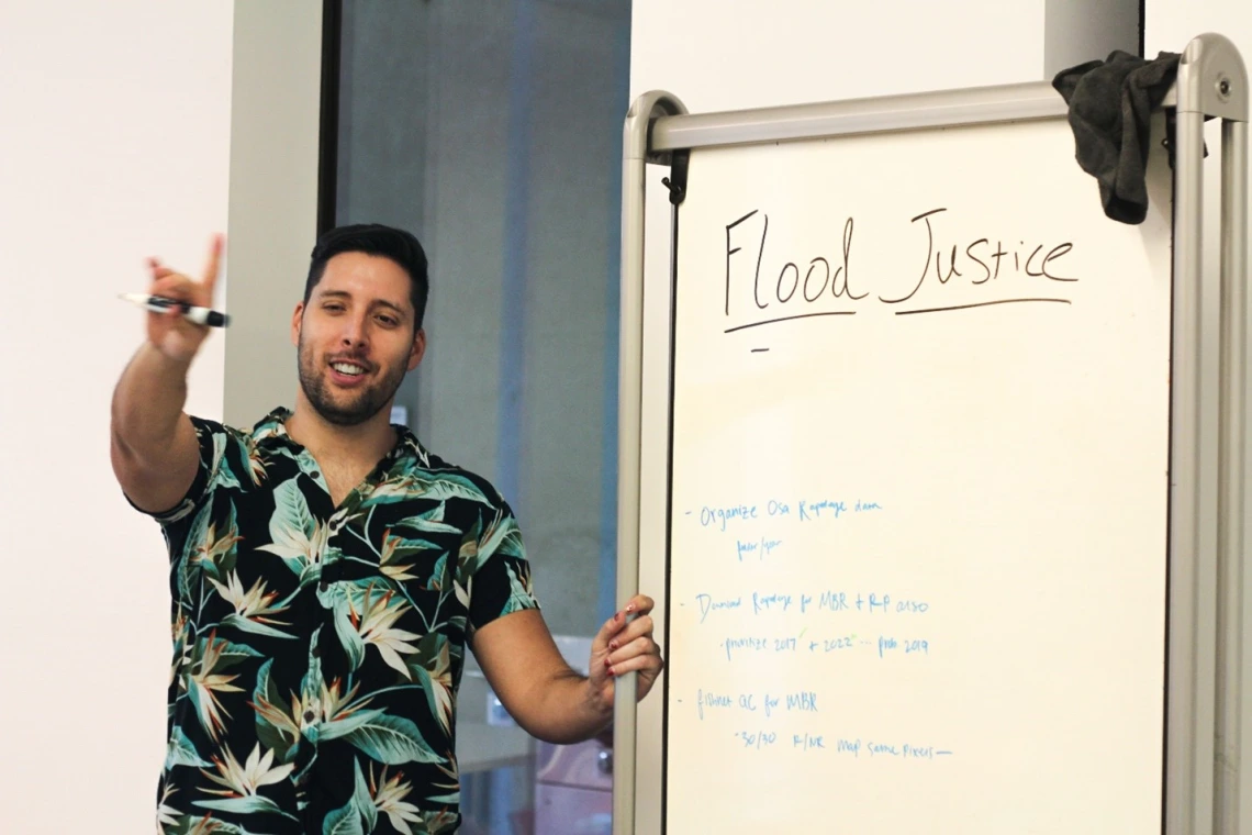
Image by Cassidy Schoenfelder: I facilitated the FLUJOS RGV launch by discussing with participants what ‘Flood Justice’ meant to them

