El Niño Tracker - September 2015
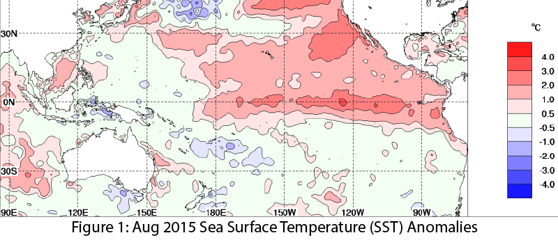
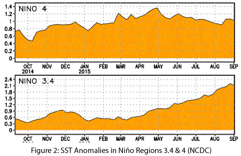
El Niño conditions continued for a seventh straight month, and forecasts and models indicate this event likely will last through spring 2016, remaining strong through the early part of the year. Forecasts focused on the persistence of sea-surface temperature (SST) anomalies (Figs.1–2) and weakened trade winds, ongoing convective activity in the central and eastern Pacific, and El Niño-related ocean-atmosphere coupling.
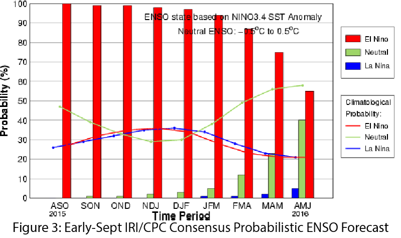
On September 10, the Japan Meteorological Agency identified persistent El Niño conditions in the equatorial Pacific, especially SST anomalies and convective activity, and forecast that the current El Niño conditions were likely to persist through winter. That same day, the NOAA-Climate Prediction Center (CPC) extended its El Niño advisory, predicting a 95 percent chance that El Niño will continue through winter 2015–2016, with gradual weakening into spring 2016 (Fig. 3). The center cited persistent positive SST anomalies in the central and eastern Pacific and ongoing ocean-atmospheric coupling and convection activity as indicators of an ongoing and strengthening event. On September 15, the Australian Bureau of Meteorology maintained its tracker at official El Niño status; a strong event with the potential to exceed the 1997–1998 El Niño in strength. On September 17, the International Research Institute for Climate and Society (IRI) and CPC forecasts corroborated the forecast of a strong El Niño with the potential to rival the strongest events on record.
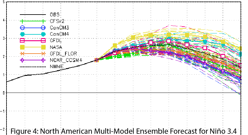
The North American multi-model ensemble currently shows a strong event extending into 2016 (Fig. 4). Emergent questions have centered on how this event compares to other strong events such as those in 1982–83 and 1997–98. If El Niño remains on this trajectory, it will likely be one of the top three strongest events on record since 1950. Sensationalistic media coverage already has started but it will be important to temper expectations without minimizing possible impacts. Forecast consensus is for a strong El Niño that extends into winter 2015–2016 and would likely bring above-average winter precipitation in the Southwest, particularly later in the season. It is important to note that this relationship suggests that a strong El Niño event gives the Southwest a much better chance at increased precipitation totals by March or April, but it is far from a guarantee of increased precipitation. In the more immediate future, El Niño conditions could lead to a repeat of 2014’s above-average eastern Pacific tropical storm season, when conditions favorable to El Niño were thought to be driving increased tropical storm activity in the Southwest in September and October.