El Niño Tracker - Nov 2015
Originally published as part of the Nov 2015 CLIMAS Southwest Climate Outlook
El Niño conditions continued for a ninth straight month, and models continue to forecast a strong El Niño event that likely will last through spring 2016 and remain strong through the early part of the year. Forecasts focused on the persistence of sea-surface temperature (SST) anomalies (Figs.1–2) and weakened trade winds, enhanced convective activity in the central and eastern Pacific, and El Niño-related ocean-atmosphere coupling.
 Image Source - Australian Bureau of Meteorology
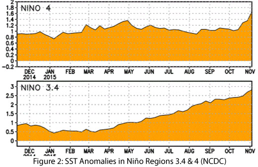 Image Source - NOAA/NWS - Climate Prediction Center
On Nov 10, 2015, the Japan Meteorological Agency identified ongoing El Niño conditions in the equatorial Pacific, and in particular “remarkably above normal” SST anomalies and atmospheric convective activity, with projections that El Niño would remain in place through spring 2016. On Nov 10, 2015, the Australian Bureau of Meteorology maintained its tracker at official El Niño status, remarking on the persistent strength of oceanic and atmospheric indicators. On Nov 12, 2015, the NOAA-Climate Prediction Center (CPC) extended its El Niño advisory, and identified the current atmospheric and oceanic anomalies as reflecting “a strong and mature El Niño episode”. Their models indicate the El Niño event will persist through winter, with a transition to ENSO neutral conditions by late spring or early summer. On Nov 19, the International Research Institute for Climate and Society (IRI) and CPC forecasts indicated that both sea surface temperature anomalies and atmospheric variables were indicative of a strong El Niño event, with consensus centering on strong El Niño conditions that might strengthen even more into early winter 2015-2016, before gradual weakening into spring 2016 (Fig. 3).
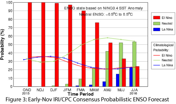 Image Source - International Research Institute for Climate & Society
The North American multi-model ensemble currently shows a strong event extending into 2016 with gradual weakening heading into spring (Fig. 4). The ocean and atmosphere are indicative of a strong El Niño event that shows no sign of weakening, and current forecasts that have it pegged as one of the strongest events on record. There is little doubt that El Niño will remain on the current trajectory in the near term, and we will see one of the top three strongest events on record since 1950.
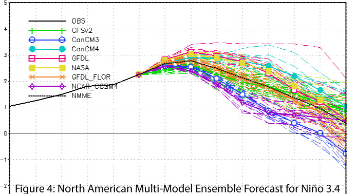 Image Source - NOAA/NWS - Climate Prediction Center
What does this mean for the Southwest? Seasonal forecasts and past events suggest we should see well above-average cumulative precipitation totals over the cool season. We should not expect a winter of daily rains, however, as there will likely be periods of inactivity between storms. Looking at the 1997–1998 event—the strongest El Niño event on record—most of Arizona and New Mexico received above-average precipitation in December but below-normal precipitation for all of January before returning to normal or above-normal precipitation in February and March (Figs. 5–8).
 Image Source - Western Regional Climate Center - WestWide Drought Tracker
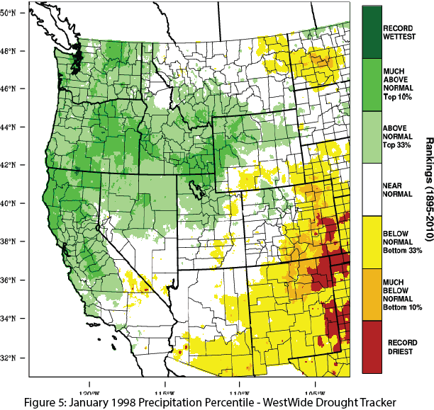 Image Source - Western Regional Climate Center - WestWide Drought Tracker
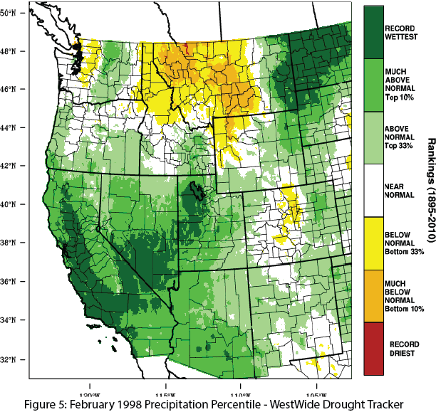 Image Source - Western Regional Climate Center - WestWide Drought Tracker
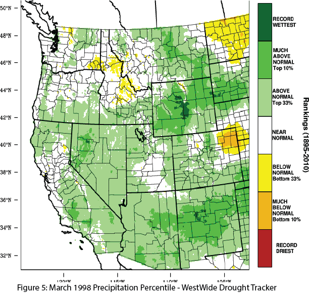 Image Source - Western Regional Climate Center - WestWide Drought Tracker
In order to track this variability and provide data and analysis regarding possible impacts of El Niño on the Southwest, CLIMAS has created an El Niño hub. This is our repository for news and information about the expected impacts of El Niño, from the perspective of what is most relevant and applicable to the Southwest. This includes what we have learned from past El Niño events, and what forecasting and models can tell us about planning for the ongoing event.