El Niño Tracker - April 2015
This was originally published in the April 2015 Southwest Climate Outlook
Strong signals in early 2014 stalled, delaying El Niño’s onset until last month, when ocean-atmosphere coupling and an additional Kelvin wave indicated more favorable conditions. Despite this late start, El Niño continued for a second consecutive month. Recent increases in sea surface temperature (SST) anomalies (Fig.1 - 2) and ongoing convective activity associated with El Niño-favorable conditions indicate we might be witnessing a two-year El Niño event. These forecasts rely on projections during a time of increasing uncertainty, and the so-called “spring predictability barrier” continues to make it difficult to anticipate how seasonal changes will help or hinder El Niño.
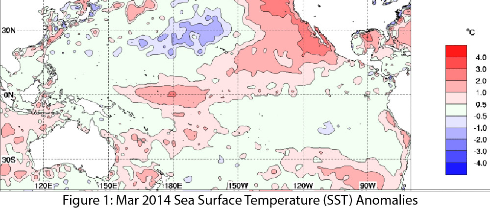
Image Source - Australian Bureau of Meteorology
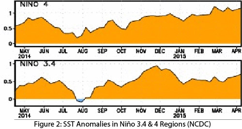
Image Source - NOAA-National Climatic Data Center
The most recent forecasts continue to offer mixed signals regarding El Niño, but are more bullish this spring than last year. On April 9, the NOAA-Climate Prediction Center (CPC) issued an El Niño advisory with a 70 percent chance that El Niño will continue through summer 2015 and more than a 60 percent chance the event would last through fall. They pointed to the large Kelvin wave, along with ongoing ocean-atmospheric coupling, as an indication a weak El Niño event would linger, with potential for further development in the long term. On April 10, the Japan Meteorological Agency declared the El Niño event likely to have ended in winter 2015, with current conditions being ENSO-neutral, but also projected El Niño conditions could return by summer. On April 14, the Australian Bureau of Meteorology upgraded their tracker to “alert” status (one below an official El Niño designation), with warming in the tropical Pacific, weak trade winds, and projected additional ocean warming listed as contributing factors. On April 16, the International Research Institute for Climate and Society (IRI) and CPC forecasts highlighted increasingly favorable oceanic and atmospheric conditions, with an 80 percent probability of El Niño extending from summer into fall, and a 70 percent probability of El Niño extending into next winter (Fig. 3). The North American multi-model ensemble shows a weak event extending through the spring, with potential for a moderate or even strong event by summer or early fall (Fig. 4).
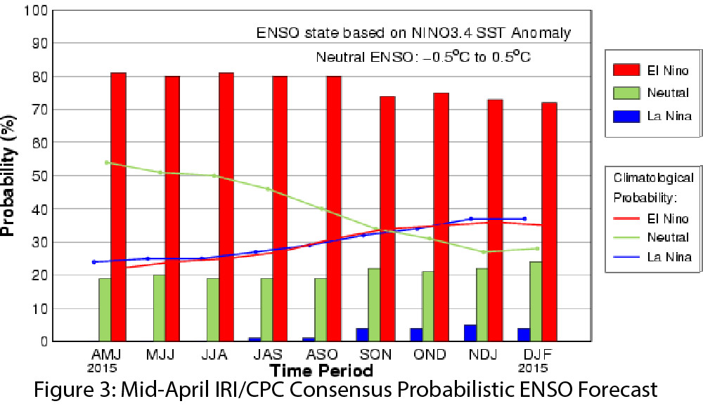
Image Source - International Research Institute for Climate and Society
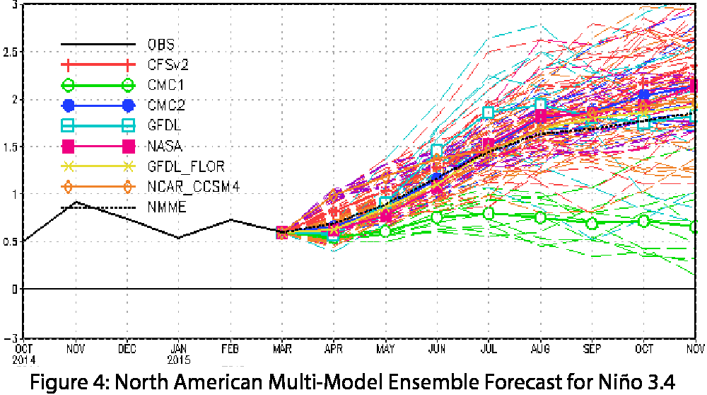
Image Source - NOAA-Climate Prediction Center
This El Niño event continues to defy expectations, with some models indicating conditions are strengthening rather than weakening during the spring transition. Forecasting or characterizing this event remains difficult given the lack of analog events in the historical record, and the complexity of this El Niño guarantees it will be of interest to climatologists for years to come. Seasonal forecasts continue to indicate an increased chance of above-average precipitation through much of the Southwest, likely tied to the presence of El Niño favorable conditions. Perhaps more interesting is the possibility of a repeat of 2014’s tropical storm season, when conditions favorable to El Niño were thought to have been driving increased storm activity in the Southwest.