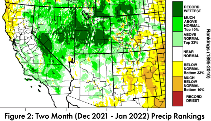
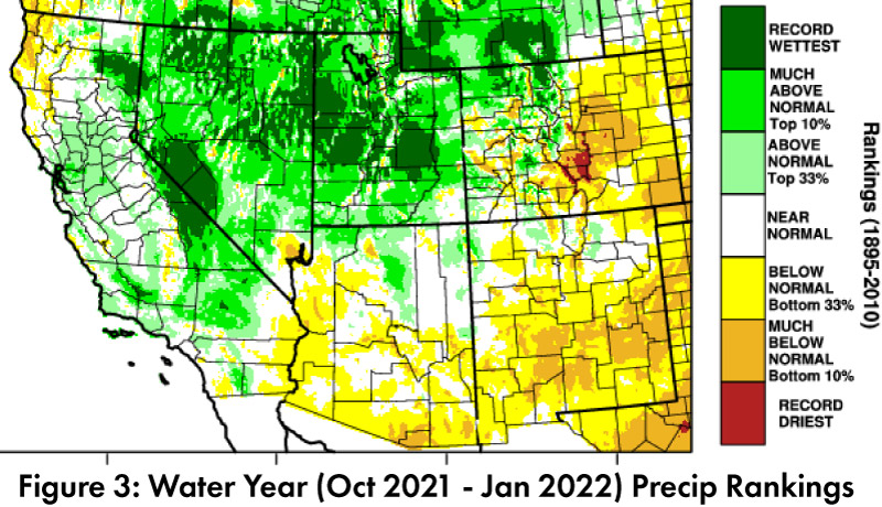
Precipitation and Temperature: Jan precipitation was between record driest and average in Arizona, and between much below average and above average in New Mexico (Fig. 1a). Jan temperatures were average to above average in Arizona and New Mexico (Fig. 1b). Two-month precipitation totals highlight a gradient that transitions from much below normal to record wettest, as you move from southeast to northwest in the U.S. Southwest and Intermountain West (Fig. 2). Water year precipitation is between much below average and average in most of Arizona and New Mexico, with pockets of above average (Fig. 3).
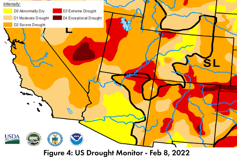
Drought: The U.S. Drought Monitor (USDM) in the Southwest is relatively stable since last month, with some increases in drought categorizations in southern and eastern New Mexico. Drought conditions are still found across nearly the entire western United States (Fig. 4). While much of Arizona has moved out of extreme and exceptional drought (D3 and D4, respectively), much of the region remains in the severe (D2) category or worse. Twenty percent of Arizona is in D2 and five-percent D3, while 48-percent of New Mexico is rated as D2, with 27-percent and 2.5-percent in D3 and D4, respectively. Long-term accumulated precipitation deficits are a factor in these designations, but recent dry conditions in January have not helped at all.
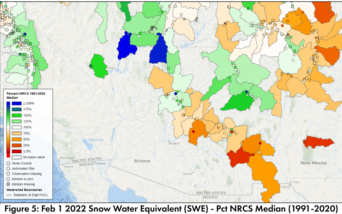
Snowpack & Streamflow: As of Feb 1, snow water equivalent (SWE) is highly variable across the Southwest (Fig. 5), with SWE ranging from well below to well above median for this time period. Feb 1 streamflow forecast includes a less optimistic picture for much of the Colorado River basins compared to last month, with southern Arizona and New Mexico basins showing the lowest probability of exceeding the 50% forecast threshold (Fig. 6). With limited winter storm opportunities remaining for the Southwest, and outlooks that call for warm and mostly dry conditions, this may be where the scope of La Niña’s influence on the region is most apparent.
Water Supply: Most of the reservoirs in Arizona and New Mexico are at or below the values recorded at this time last year. Most are also below their long-term average (see reservoir storage for Arizona and New Mexico). The outlook for warm and dry conditions does not bode well for short-term water storage and will continue to raise concerns about Lakes Mead and Powell and the Colorado River, along with Elephant Butte on the Rio Grande, about long term storage and regional sustainability.
ENSO Tracker: ENSO conditions appear to have peaked at a weak La Niña with a likely transition to ENSO-neutral in spring or summer. This is based on observed and forecast SSTs, atmospheric conditions, and coupling between the two that is indicative of La Niña (see ENSO-tracker for details).