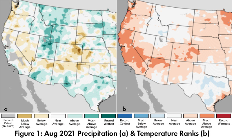
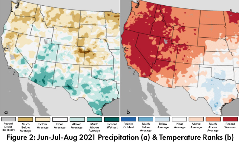
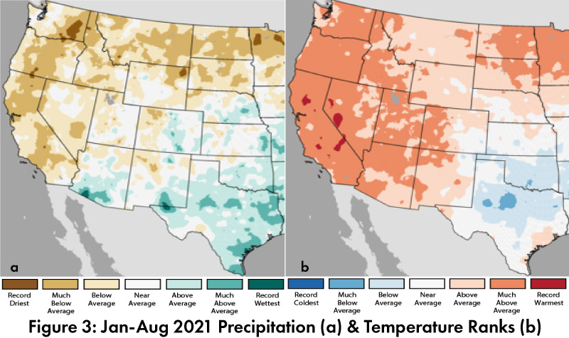
Precipitation and Temperature: August precipitation was between much below average and much above average in Arizona and New Mexico (Fig. 1a). August temperatures were average to much above average in Arizona and New Mexico (Fig. 1b). Summer precipitation ranks (Jun-Aug) were below average to record wet in Arizona and New Mexico, with much of the region recording wetter than average seasonal totals (Fig. 2a). Temperature ranks for summer (Jun-Aug) were above average to record warm across the Southwest (Fig. 2b). Annual totals are skewed by the wet monsoon in southern Arizona and parts of New Mexico, while most of the rest of the southwest was average to below average for precipitation, and above average to much above average for temperature (Fig 3a-3b).
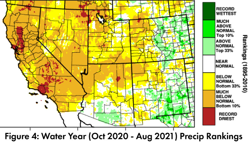
Drought: Water year precipitation (as of Aug 31, 2021) is between much below normal and above normal across most of Arizona and New Mexico, with much below normal and record driest more prevalent in much of the rest of the Southwest (Fig. 4). The U.S. Drought Monitor (USDM) further scaled back drought categorizations in New Mexico and Arizona, following heavy monsoon precipitation (Fig. 5). The monsoon storms brought short-term relief, while long-term and cumulative precipitation deficits remain a concern.
Water Supply: Most of the reservoirs in the region are at or below the values recorded at this time last year. Most are also below their long-term average (see Arizona and New Mexico reservoir storage).
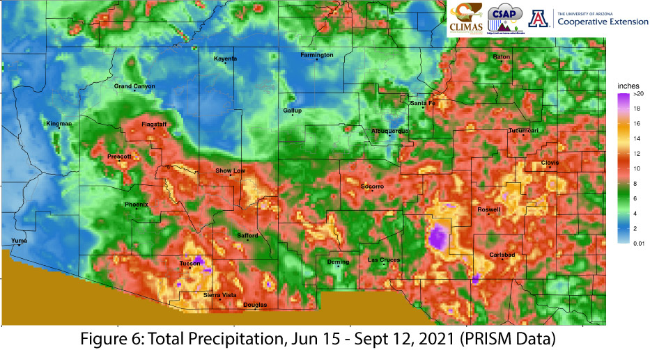
Monsoon Tracker: Monsoon activity was widespread and persistent through mid/late August but has tapered in the first few weeks of September. The season generally reflects the normal timing and progression of monsoon activity, even if some of the seasonal totals are much higher across parts of the region, and in southern/central Arizona in particular (Fig. 6; Totals as of Sept 12, 2021; SW Monsoon Tracker for more maps and information). There is still time for some locations to break monsoon records, but the probability of widespread monsoon or transitional activity is relatively low at this point. Nora brought moisture into the Southwest in early September, but at this time, there are no tropical storms queued up to bring late-season incursions of moisture, and the forecasts through the end of September are for drier than normal conditions.
ENSO Tracker: ENSO conditions are neutral but seasonal outlooks are uncertain about La Niña this winter. This is based on cooling sea surface temperatures (SSTs) that would suggest a La Niña event, and models that lack certainty about the duration of La Niña, and whether it would reach and remain below SST thresholds long enough to be classified as a La Niña (see ENSO-tracker for details).