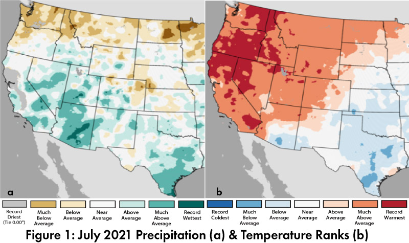
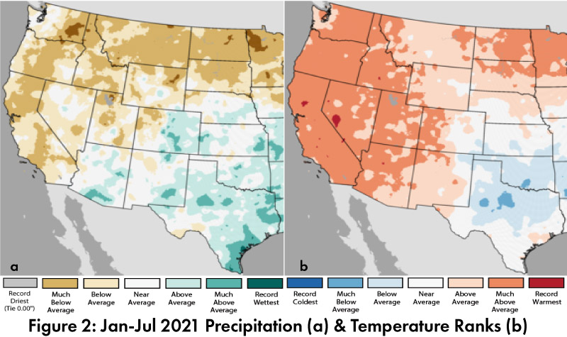
Precipitation and Temperature: July precipitation was between above average and record wet in most of Arizona, and between average and much above average in most of New Mexico (Fig. 1a). July temperatures were below average to average in most of New Mexico and most of southern Arizona, with much above average to record warmest in most of the rest of the western United States (Fig. 1b). 2021 precipitation ranks to date (Jan-Jul) were between below average and above average in most of Arizona and New Mexico, with drier-than-average conditions in most of the Southwest (Fig. 2a). Temperature ranks for 2021 were above average to much above average across most of the Southwest (Fig. 2b).
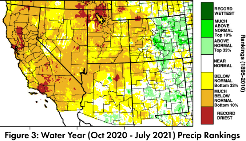
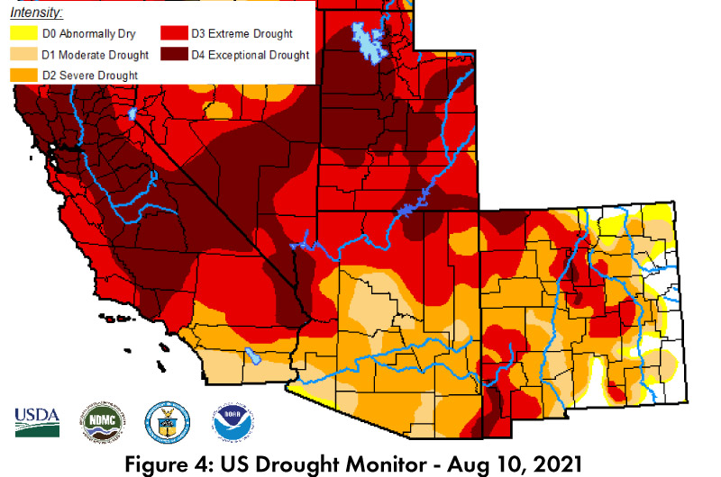
Drought: Water year precipitation (as of Jul 31) is between below normal and above normal across most of Arizona and New Mexico, and much below normal to record driest in much of the rest of the Southwest (Fig. 3). The U.S. Drought Monitor (USDM) scaled back drought categorizations following numerous monsoon events (Fig. 4), which has dramatically improved short-term drought conditions but has had little impact so far on longer-term impacts showing up in sectors like water resources.
Water Supply: Most reservoirs in the region are at or below the values recorded at this time last year. Most are also below their long-term average (see Arizona and New Mexico reservoir storage).
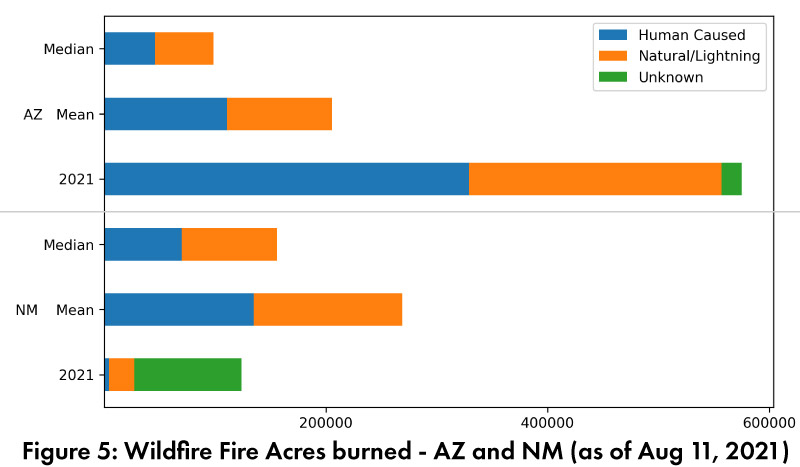
Wildfire: Monsoon activity has tamped down fire risk and activity in Arizona and New Mexico. As of Aug 11, total acres burned have not changed much from last month; Arizona is much above mean and median and New Mexico is at or below mean and median (Fig. 5). The National Interagency Fire Center (NIFC) significant wildland fire potential outlooks call for below-normal wildfire risk in much of Arizona and New Mexico in August, and normal wildfire risk in September and October.
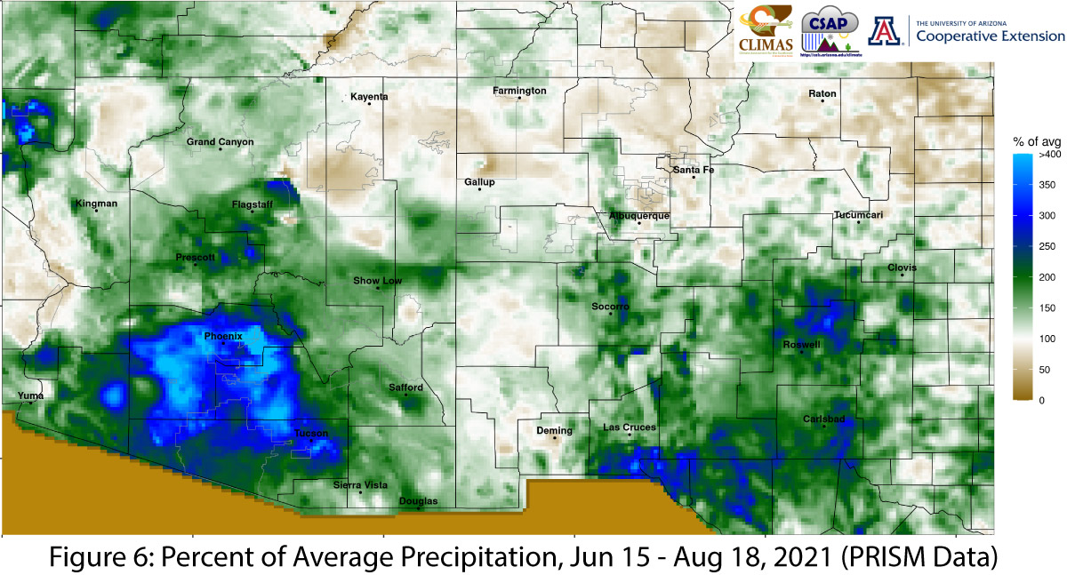
Monsoon Tracker: Monsoon activity through Aug 16 has been widespread and persistent. Much of the region recorded between normal and much above normal precipitation (Fig. 6; see Monsoon Tracker for details). There is still time for some locations to break monsoon records if this pattern continues.
ENSO Tracker: ENSO conditions are neutral, and there is not yet consensus in the seasonal outlooks about the certainty of a La Niña event this fall and winter (see ENSO-tracker for details).
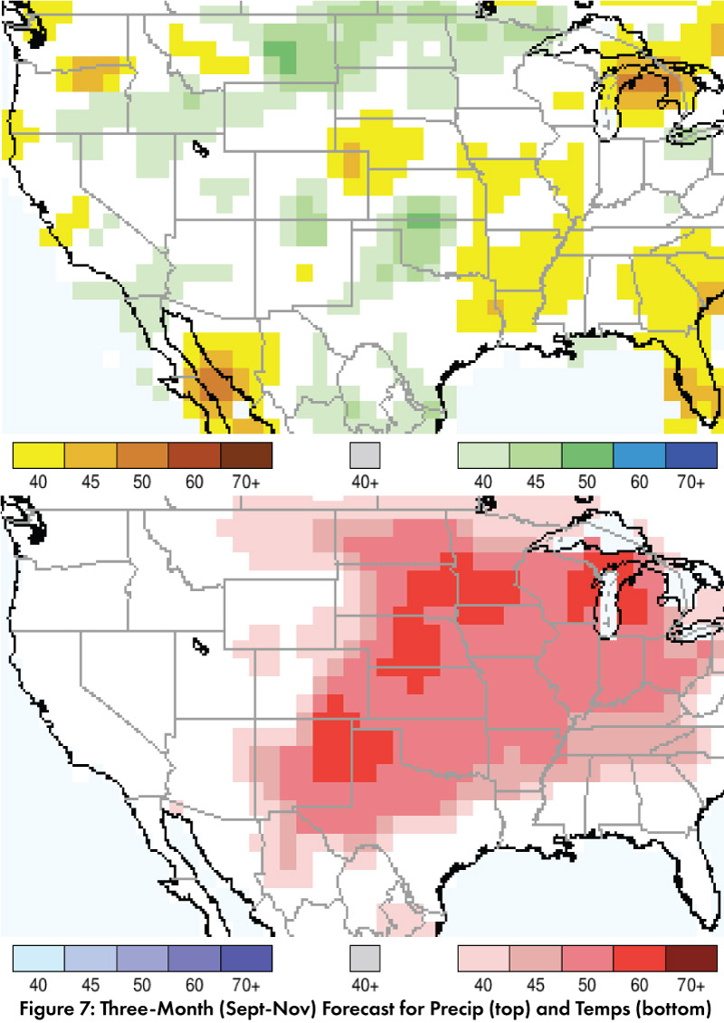
Precipitation and Temperature Forecast: The three-month outlook (Sept-Nov) calls for increased chances for above-normal precipitation in a few areas of Arizona and New Mexico (Fig. 7, top). The temperature outlook calls for equal chances of normal, above-, or below-normal temperatures in most of Arizona and increased chances of above-normal temperatures in most of New Mexico (Fig. 7, bottom).