Southwest Climate Outlook May 2019 - Climate Summary
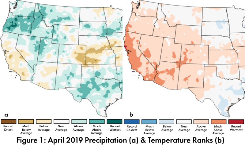
April Precipitation and Temperature: April precipitation was average to much above-average in most of New Mexico, while Arizona ranged from below-average to above-average (Fig. 1a). April temperatures were almost entirely above-average to much above-average across the Southwest (Fig. 1b), while temperatures so far in May have been mostly below-average.
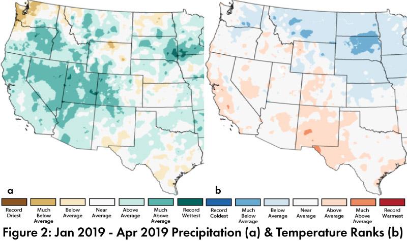
Seasonal Precipitation and Temperature: Year-to-date precipitation (Jan-Apr) is above-average for most of the western U.S. (Fig. 2a). Most of Arizona and northern New Mexico were above-average or much above-average, and across the Southwest, only southern New Mexico and far west Texas recorded below-average precipitation. Temperatures for Jan-Apr were average to above-average in Arizona and mostly above-average in New Mexico (Fig. 2b).
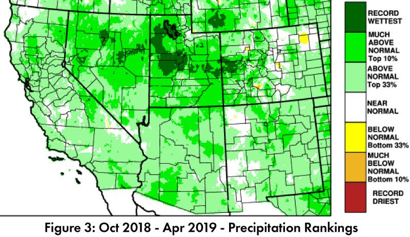
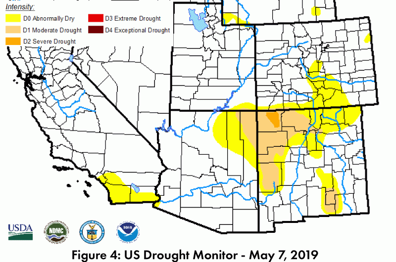
Drought: Water year precipitation is above normal (top 33%) for much of the Southwest, with large areas of much above normal (top 10%) and smaller pockets of record wet conditions (Fig. 3). The May. 7 U.S. Drought Monitor (USDM) continues to show improvements in regional drought conditions in the Southwest, with Arizona nearly clear of drought designations, and the intensity of drought characterizations in the four corners region and northern New Mexico further reduced compared to last month (Fig. 4).
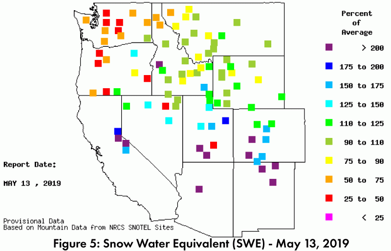
Snowpack & Water Supply: Late season snowpack in the Southwest is waning, and snow water equivalent (SWE) in Arizona and New Mexico reflect this seasonal transition. Many stations are no longer reporting values, but those still reporting show over 200-percent of average (Fig. 5). Upper elevation areas in Utah and Colorado mostly range from 110- to 200-percent of average, which bodes well for short term reservoir storage (see streamflow forecast and Arizona and New Mexico reservoir diagrams).
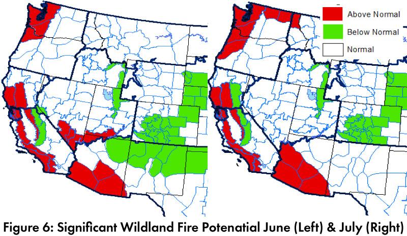
Wildfire, Health, and Safety: Wildfire outlooks for June and July paint a similar picture for lower elevation areas of Arizona, with above normal fire risk (Fig. 6), linked to widespread fine fuel growth driven by above-average precipitation in the cool season. Northern Arizona and New Mexico are projected to see below normal fire risk in June and return to normal risk in July. Cool season precipitation has done wonders for the wildflower season and helped with drought, but wildfire risk and the impact of pollen production for allergy sufferers provide examples of trade-offs associated with increased precipitation.
El Niño Tracker: Atmospheric and oceanic conditions remain in line with a weak El Niño, and most forecasts call for this event to last at least through summer. There is considerable uncertainty, however, for forecasts made in Spring, and in the Southwest, there is little in the way of a precipitation signal to alter in May and early June (see El Niño tracker for more details).
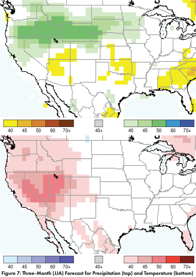
Precipitation and Temperature Forecast: The three-month outlook for June through August calls for increased chances of below-normal precipitation in northern and central Arizona and equal chances of above- or below-normal precipitation in much of the rest of Arizona, New Mexico, west Texas, and northern Mexico (Fig. 7, top). The three-month temperature outlook calls for increased chances of above-normal temperatures in most of Arizona, and parts of northern New Mexico, and northern Mexico, with equal chances of above- or below-average temperatures in the rest of the region (Fig. 7, bottom).
Online Resources
- Figures 1-2 - National Centers for Environmental Information - ncei.noaa.gov
- Figure 3, 5 - Western Regional Climate Center - wrcc.dri.edu
- Figure 4 - U.S. Drought Monitor - droughtmonitor.unl.edu
- Figure 6 - National Interagency Fire Center - droughtmonitor.unl.edu
- Figure 7 - International Research Institute for Climate and Society - iri.columbia.edu